USS Helena at Pearl Harbor
7 December 1941

The Attack
Page 2

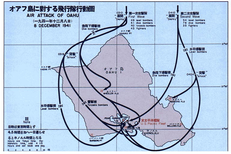
On the morning of Sunday, 7 December 1941,
the Helena was at Berth B2 at the 1010 Dock.

This was Pennsylvania's usual berthing location but
she was in one of the dry docks that day.

1010 Dock is part of the Pearl Harbor Navy Yard and
the Helena was there while waiting to get into Dry Dock #2.

Some of the other cruisers were moored in their usual spots close to Aiea .

No carriers were in port this day.

At 0702 the radar outpost at Opana picked up the
first hint of aircraft approaching Oahu.

The numbers began to increase and the two men operating the radar notified
the Air Information Center at Fort Shafter.

No action was taken.

The complete track from 0702 to about 0740 is in Page 1

From the 2021 National WWII Museum International Conference
18-20 November 2021
Dr Richard Frank and Dr Rob Citino:


Had the warning been acted on :

1. There would have been enough time for the ships to tighten up and have ammunition ready.

2. There would have been no effect on the aircraft at either Wheeler or Hickam Fields.
None were ready for combat.

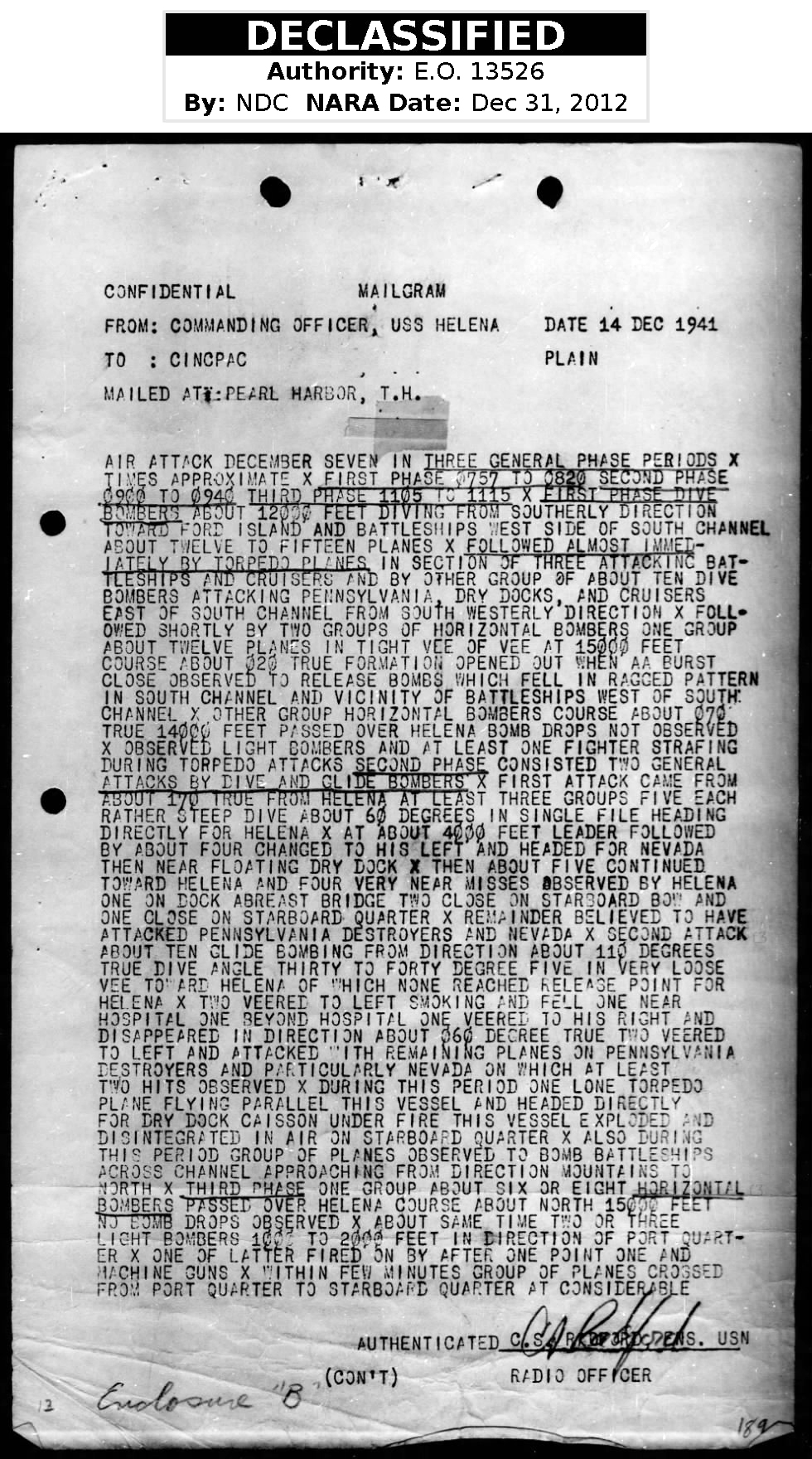
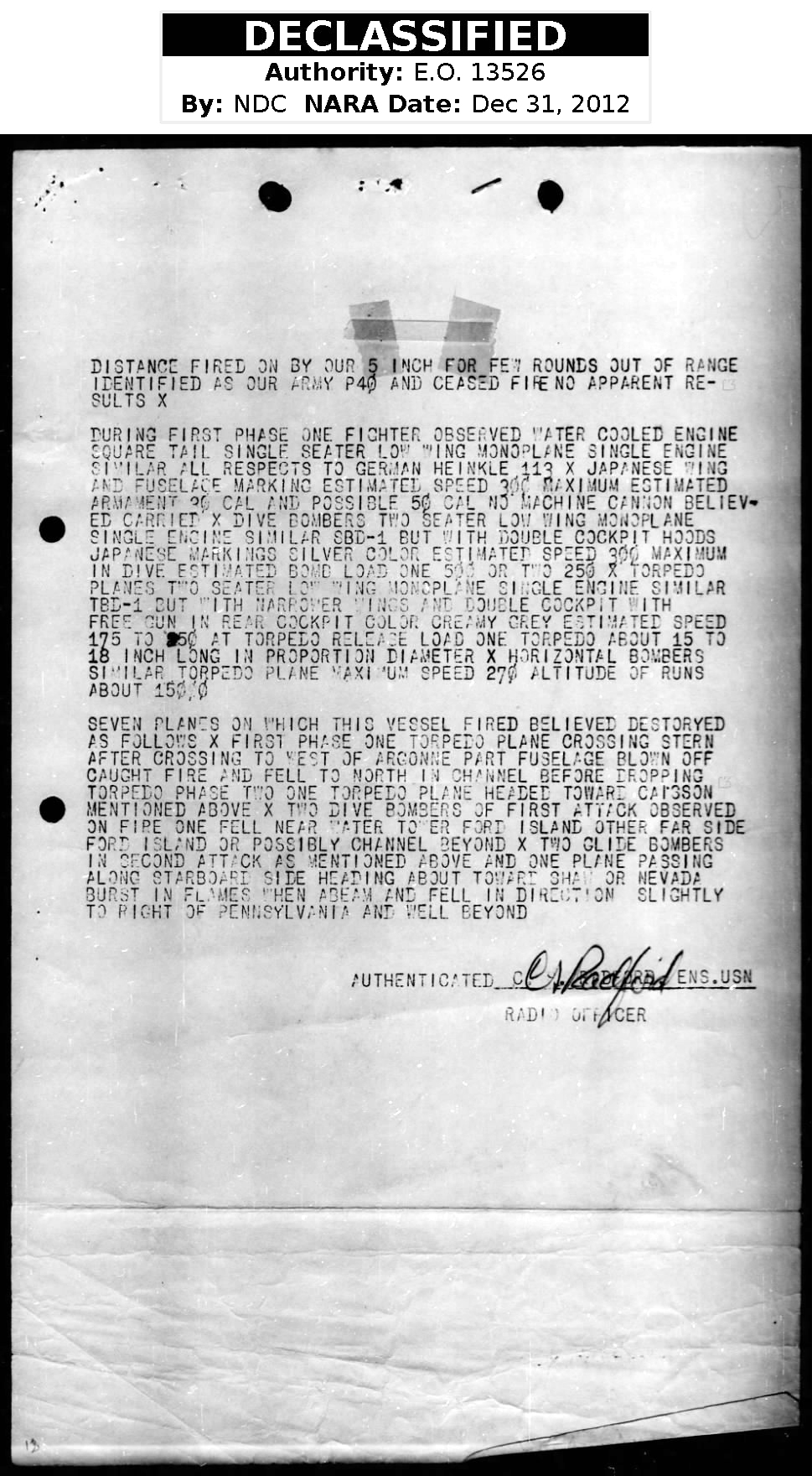
The first document below is the MAILGRAM sent to CINCPAC from
Commanding Officer, USS Helena, 14 December 1941.

These two pages contain a concise summary of the attack
from the perspective of the Helena.


Planes observed over Ford Island from Helena at 0757.
Altitude 4000 feet.
General Quarters sounded

The large Fuchida map in Page 1 shows five torpedoes
heading towards the Helena and Oglala.

One of these five torpedoes hit the Helena.

One report states this this torpedo was dropped about 500 yards from the Helena.

0759 Helena hit, ~1 min after GQ and
90 seconds after 1st enemy aircraft spotted over Ford Island

In Page 3 is one page of an article explaining
what took place with the remaining four torpedos


Four bomb near misses around the Helena
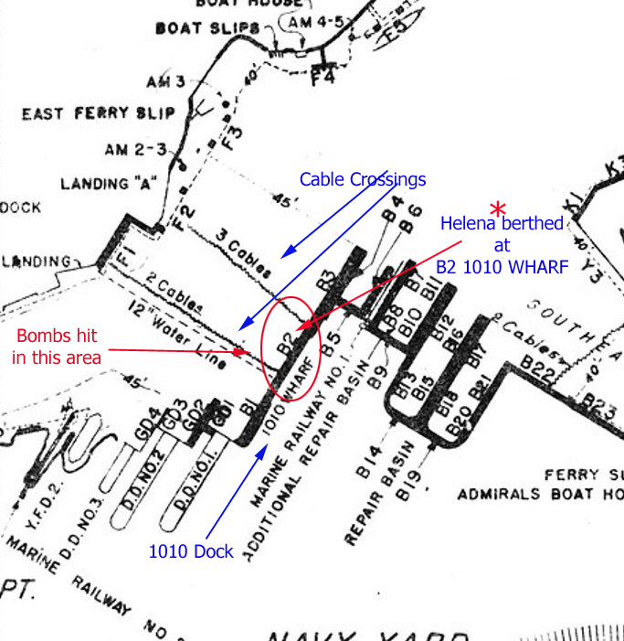
 are mentioned in the MAILGRAM

One of these hit the 1010 Dock.

or

Was this actually from a torpedo hitting the 1010 Dock ?


Situations that I do not have answers for :

The Oglala was outside the Helena, closer to Ford Island.

1. Could torpedo tracks have been seen from the Helena.

2. How close to the Oglala were the near misses from bombs.
Were they in the area of the bow, midship, or stern.


The Oglala reported torpedo and bomb explosions at 0757 and 0800.
She reported that a bomb fell between the two ships which were about 8 feet apart.

See Torpedo and Bomb Damage Report, Page 1

More Questions:

1. Did a bomb fall between the ships or

2. Was this explosion from the torpedo that hit the 1010 Dock.

3. Could the force of this torpedo explosion have impacted the Oglala.


In mid-November 2021, Mike Wenger, historian and author,
told me what he knew about the torpedo attack and the 1010 Dock.

From Mike:

There was damage to the 1010 dock.
The pavement between the edge of the dock and
the building ( maybe the sub station ) was not completely destroyed.

The dock may have collapsed from the impact of a torpedo.

This is something that he is looking into and will be in his book to be published in 2022

In Page 3 are two photos showing the dock under repair.

The near misses to the starboard side of the Helena
did cause bomb fragments and splinters to hit the side of the ship.

A few men were killed by these splinters and
and unknown number of others were injured.

Below the MAILGRAM are:

A diagram of ship locations in Pearl Harbor,

A simple map of the two waves of the attack,

A Google Satellite Map of the area between Ford Island and the 1010 Dock

BACK TO TOP


MAILGRAM TO CINCPAC
FROM
COMMANDING OFFICER, USS HELENA
PAGE 1

source: Fold3

BACK TO TOP

MAILGRAM TO CINCPAC
FROM
COMMANDING OFFICER, USS HELENA
PAGE 2

source: Fold3

BACK TO TOP


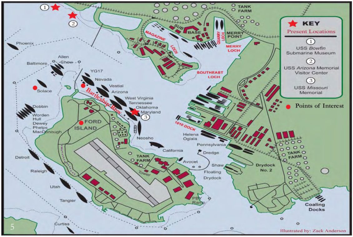
LOCATION OF US NAVY SHIPS ON MORNING OF 7 DECEMBER 1941

source: Pearl Harbor Visitor Center

BACK TO TOP

JAPANESE MAP OF AIR ATTACK OF OAHU

source: Unknown

BACK TO TOP

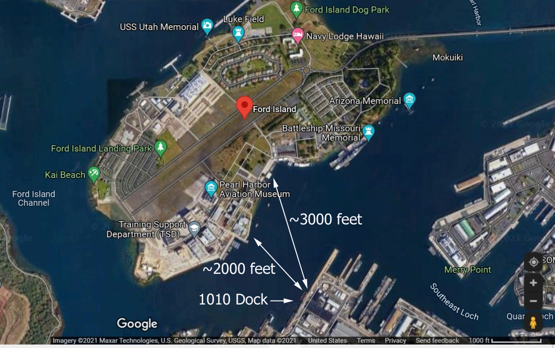
AERIAL VIEW OF FORD ISLAND AT LEFT AND 1010 DOCK

2000 FOOT DISTANCE ACROSS CHANNEL IS IF AIRCRAFT ATTACKED FROM BERTH F-9

3000 FOOT DISTANCE IS IF THE APPROACH WAS FROM THE AREA OF THE USS UTAH

SOURCE: Google maps

BACK TO TOP