1st Lt Herbert Edman
Hahn Crew
Page 2
|
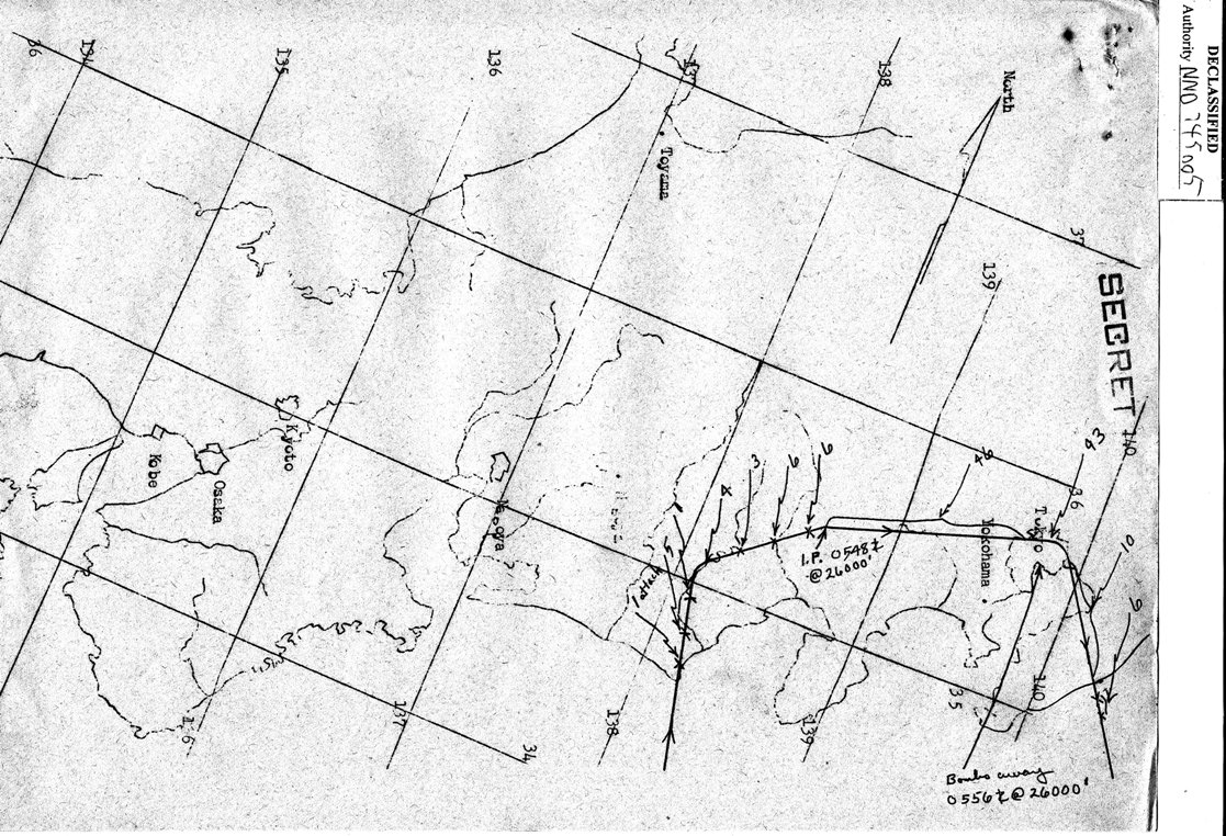
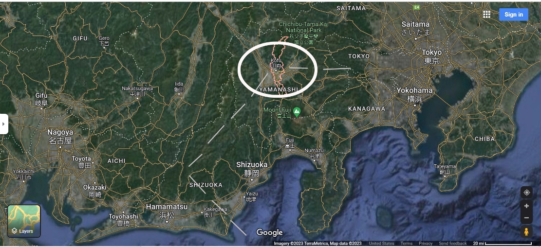
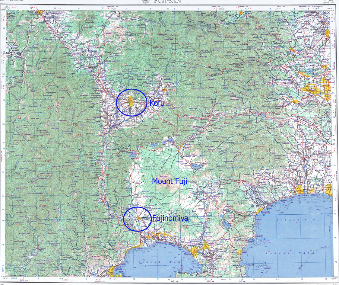
Below are three orientation maps. First map shows the planned track from landfall to the target and
then exit. The second Google map shows the approximate track ( dashed lines
) The third map is from the Perry Castaneda Collection at the University
of Texas. |
|
TRACK OF MISSION #22
|
|
TRACK OF ABOVE FROM MAP LANDFALL
source : Google Maps |
|
LOCATION OF IP ( KOFU )
|