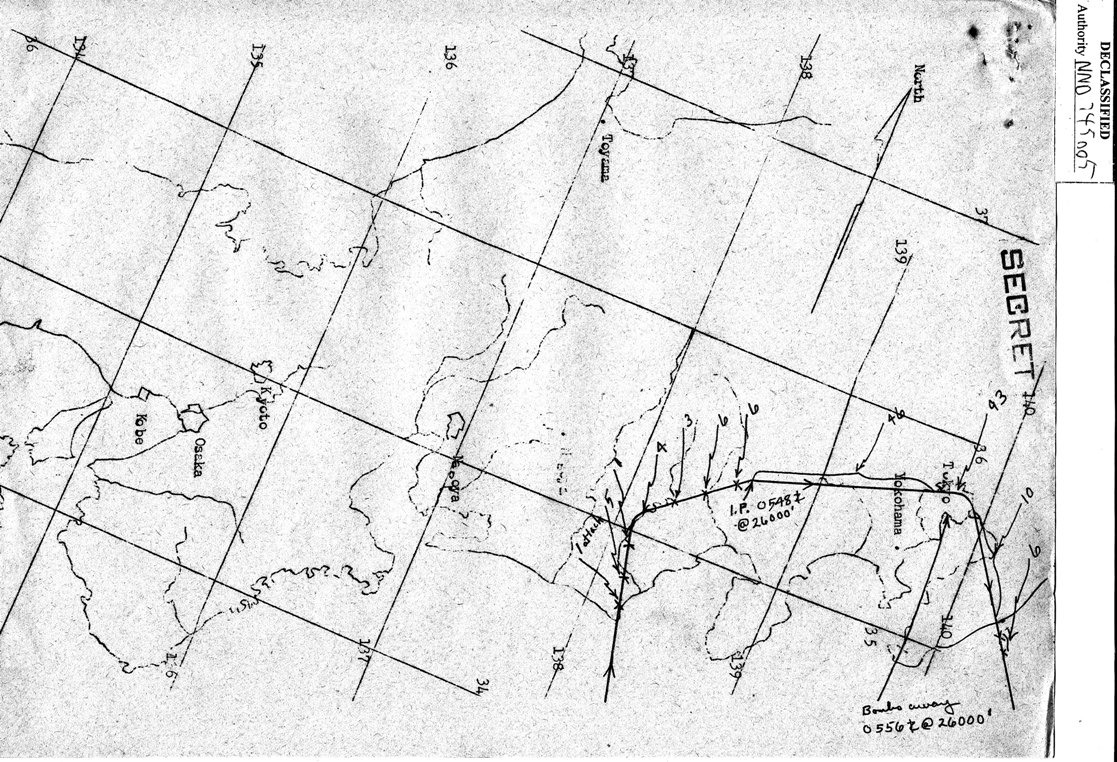
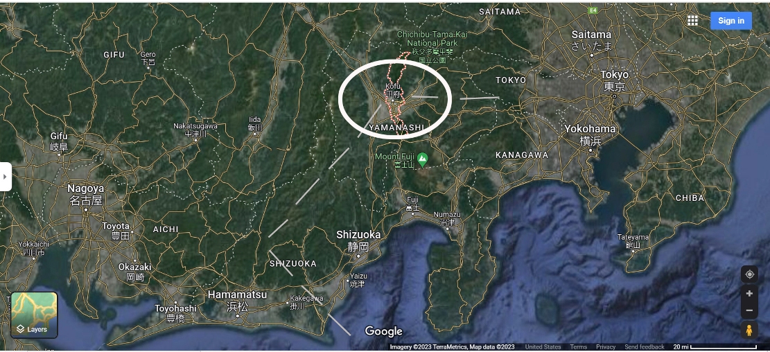
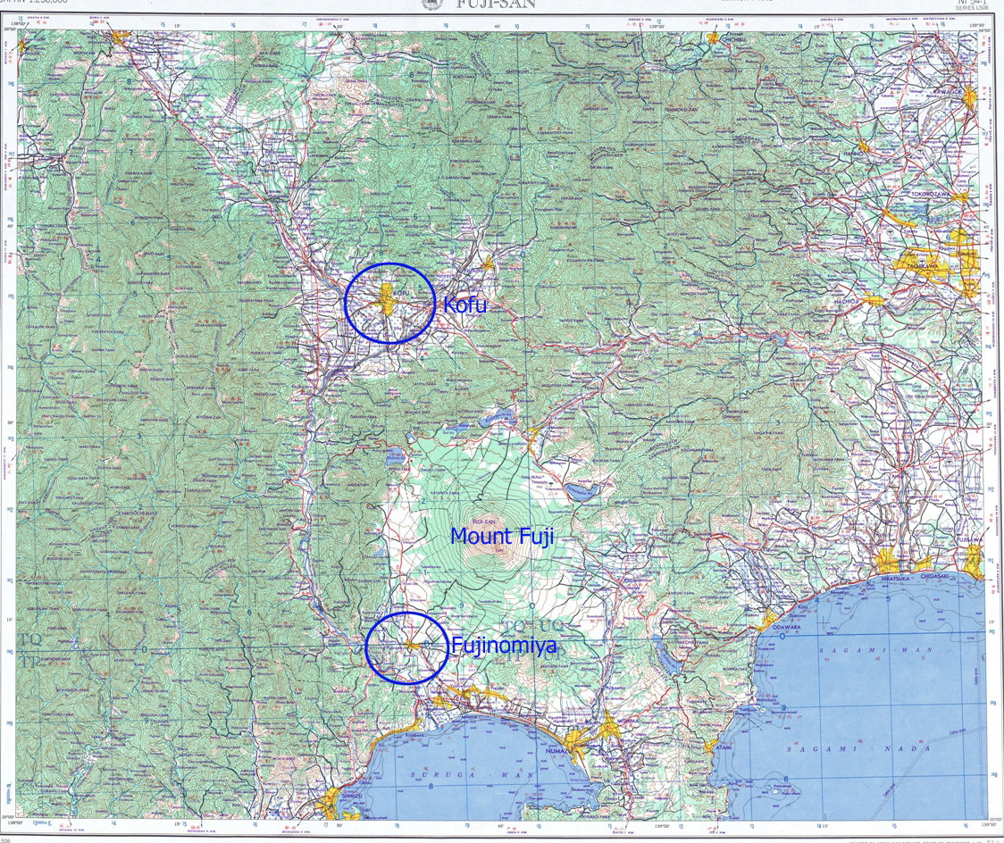
Below are three orientation maps.
Within Captain Hahn's IDPF, the 73rd Bomb Wing Mission Report,
and the Missing Air Crew Report there are no coordinates stating where
A-28 went down.
First map shows the planned track from landfall to the target and
then exit.
The numbers are the attacks by enemy aircraft.
The second Google map shows the approximate track ( dashed lines
)
in the first map along with the location of the Initial Point (IP)
at Kofu.
The IP is where the bomb run started.
The third map is from the Perry Castaneda Collection at the University
of Texas.
This is from US Army Series L506.

Cirlced in the third map are Kofu, Mount Fuji, and Fujinomiya.
Were Wolf went down in the area of Fujinomiya.
The most detailed description of this location and
the fate of the crew members is in the report by
POW Research Network Japan in Page 4.