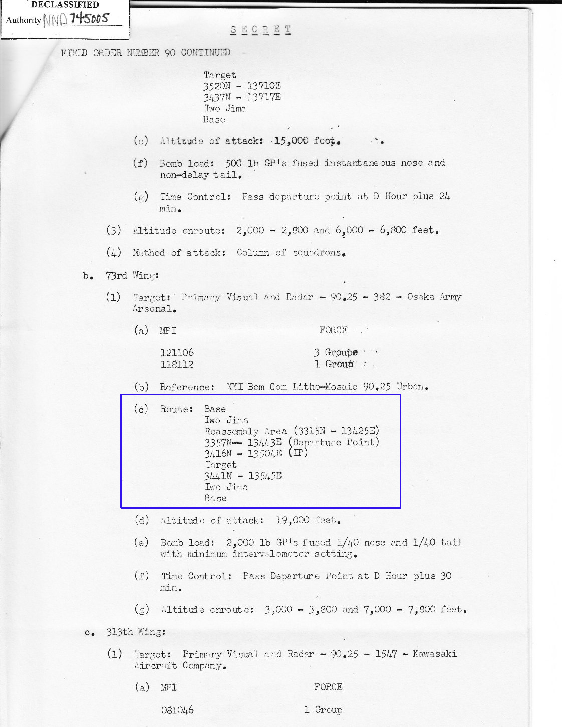
The first document is a page from the 73rd Bomb Wing Mission Report.
Outlined in blue are the locations and coordinates
that the B-29s would fly to and from Saipan.
The locations of these coordinates are in
the Navigation chart beneath this page.
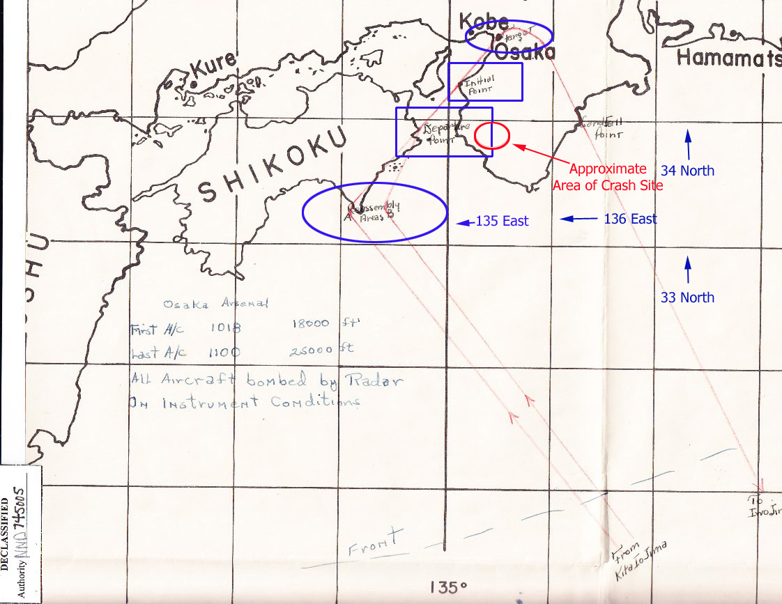
The B-29s arrived at Assembly Points A and B
to get into their formations.
This was close to the Departure Point southwest of the target.
The bomb run began at the Initial Point ( IP ) and
the B-29s were required to remain in formations.
After bombs were released the aircraft turned to
the southeast for the return to Saipan.
V-11 was hit shortly after dropping its bombs and
flew almost due South into a mountainous area in Wakayama Prefecture.
Nine of the Newell crew were able to parachute safely to the ground.
Two were still on board when their B-29 crashed into a mountain.
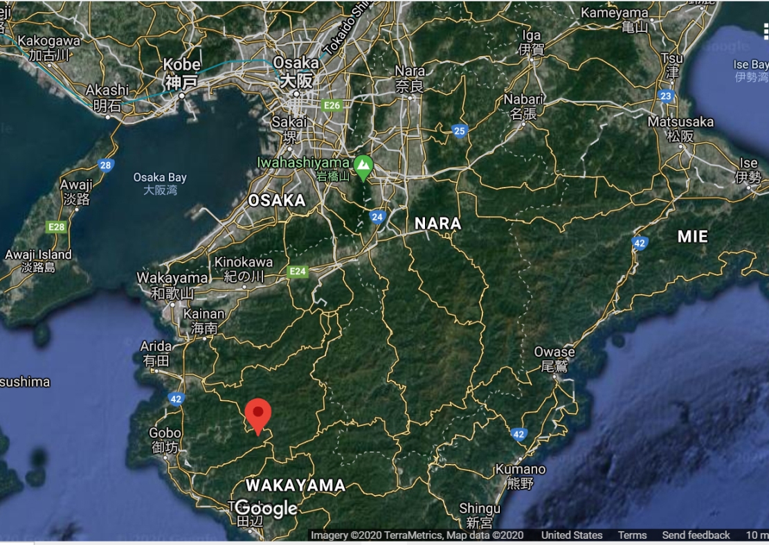
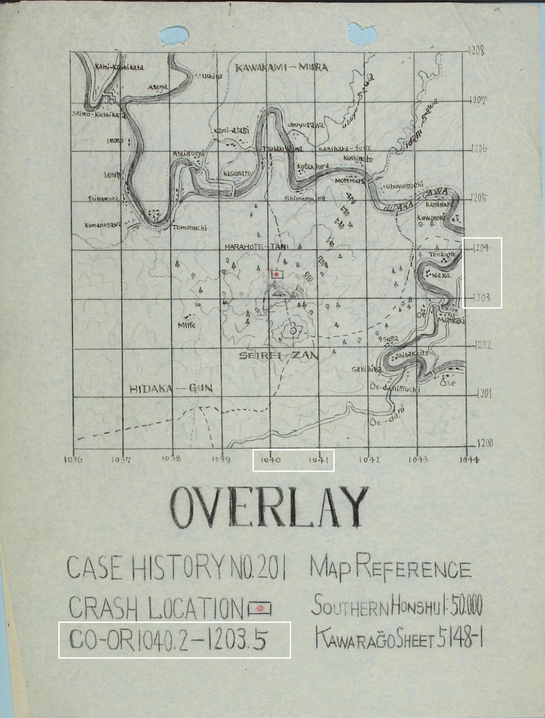
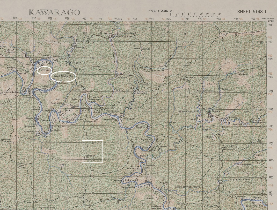
Following the Navigation Chart are three maps.
The Google map provides a general view of the crash site.
In the other two are specific locations ( coordinates )
where the crash took place.
The larger of these is a crop of
Army Map Service Series 775 Sheet 5148-1
.
White ovals show the area where some of
the crew members landed.
*************************
John Lehnen's Uncle Louis was one of the crew who
survived the crash only to be
executed at the Jonan Rifle Range on 15 August 1945.
John has kindly allowed me to use 6 pages of his work in Page 3.