SSgt Logan McGuinn Sparks
Osaka
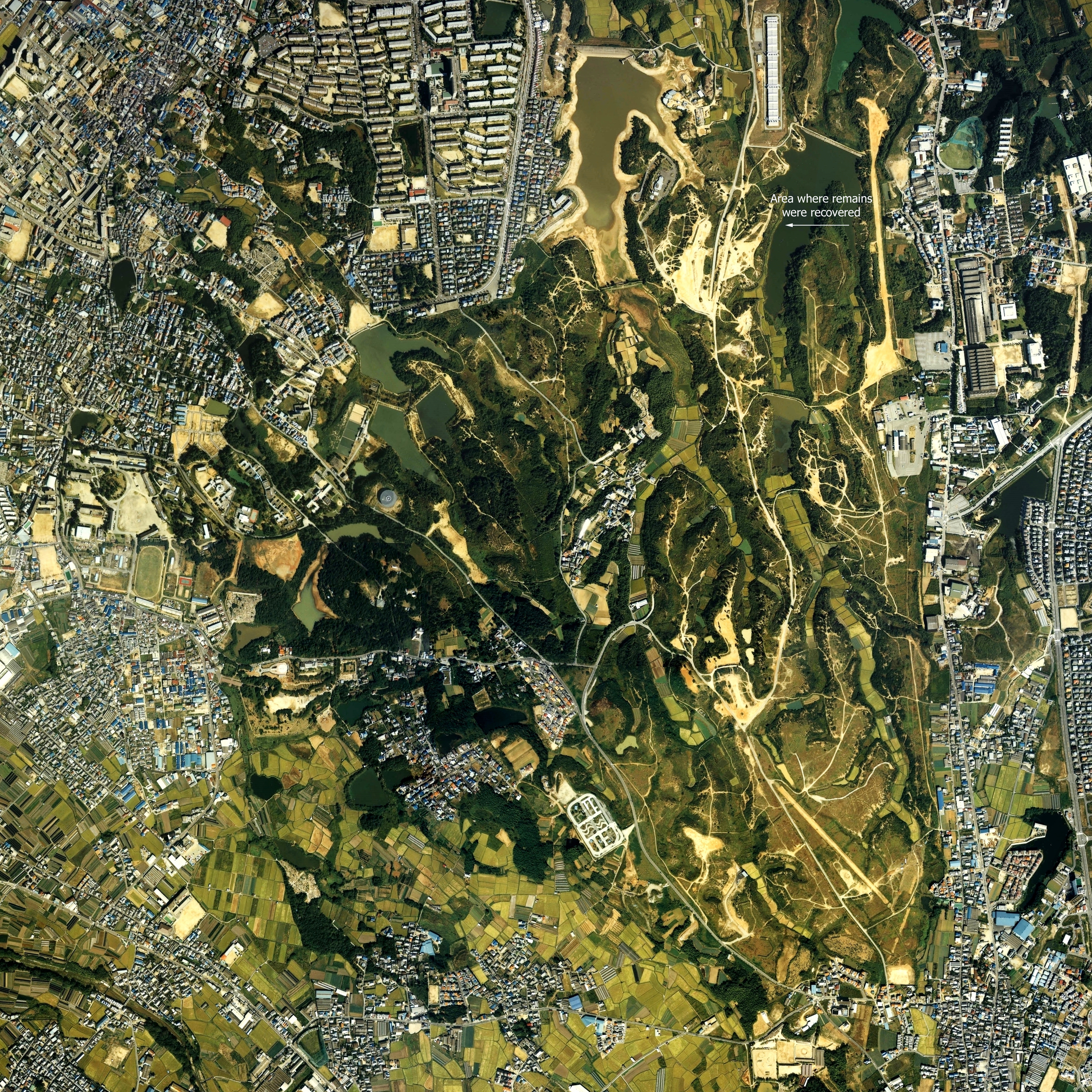
Shinodayama Military Maneuver Area
Recovery
Page 4
These two images are quite large and require considerable scrolling
|
The first of the two full size images is a 17 MB aerial photo of
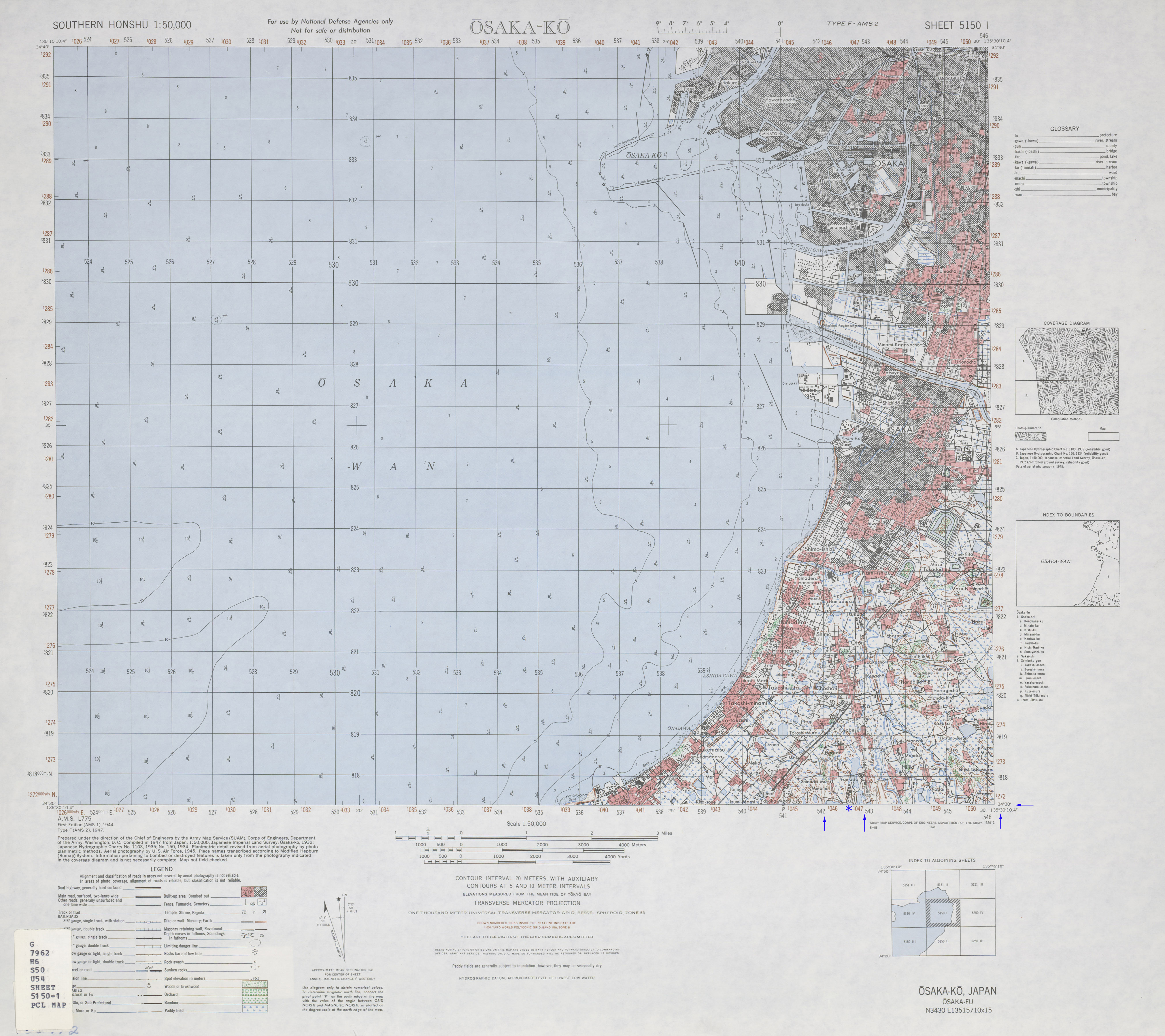
the At center left is an oval track to assist in orientation. Beneath the aerial photo is a map from the Army Map Service These coordinates are very close to the burial site The blue asterisk indicates the approximate location of where the
burial site would be |