Sgt William Walter Sutherland, Jr.
Tokyo Military Prison Fire
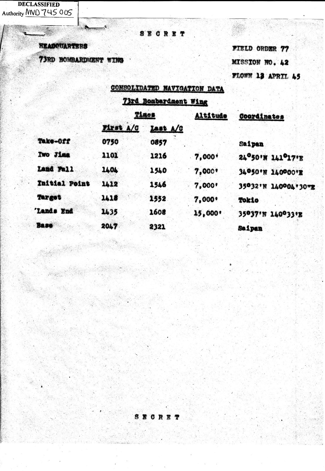
73rd Bomb WingMission No. 42
Page 2


In the right column of the Consolidated Navigation Data
are coordinates for Land Fall, the Initial Point, and Lands End.

The Initial Point ( IP ) is where the bomb run started.

The Radar CounterMeasure (RCM ) Navigation chart
shows the route that the B-29s were to fly to and from the target.

This chart begins at Latitude 26 degrees North
( Saipan is at approximately 15 degress North ).

Aircraft stamps indicate the direction that the B-29s were to fly.

The second chart is a close in view of the target area along
with times of first and last aircraft that match
data in Consolidated Navigation Data.


CONSOLIDATED NAVIGATION DATA

BACK TO TOP

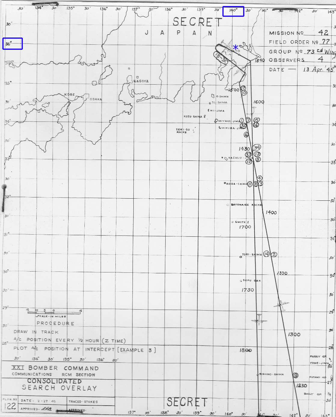
RADAR COUNTERMEASURE NAVIGATION CHART
* APPROXIMATE LOCATION OF CRASH SITE

AIRCRAFT STAMP SHOWS FLIGHT DIRECTION

BACK TO TOP

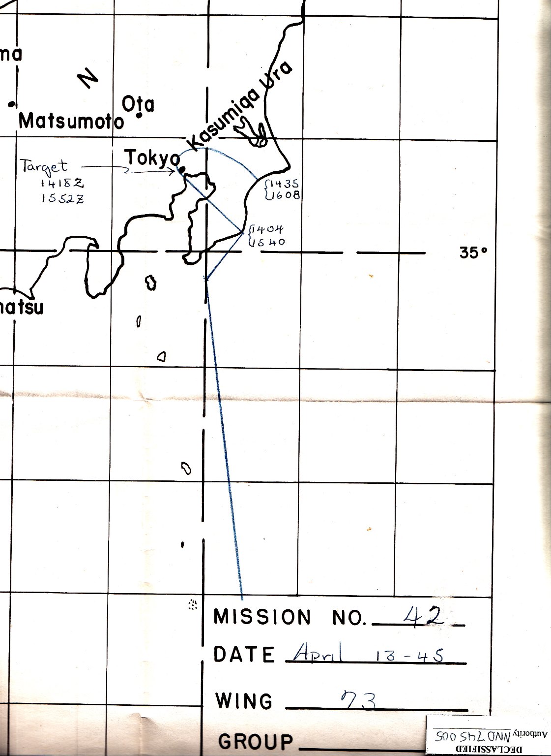
CLOSE UP NAVIGATION CHART
TO AND FROM TARGET OVER JAPAN

BACK TO TOP