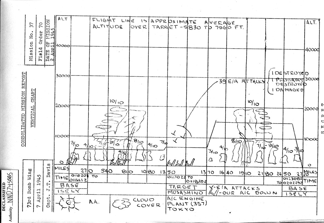
The focus of this page is Navigation.
The Vertical Chart shows the approximate locations where 6 B-29s
were lost.
Three were in vicinity of the target.
Other information includes the altitude flown
during various stages of the Mission
and weather conditions.
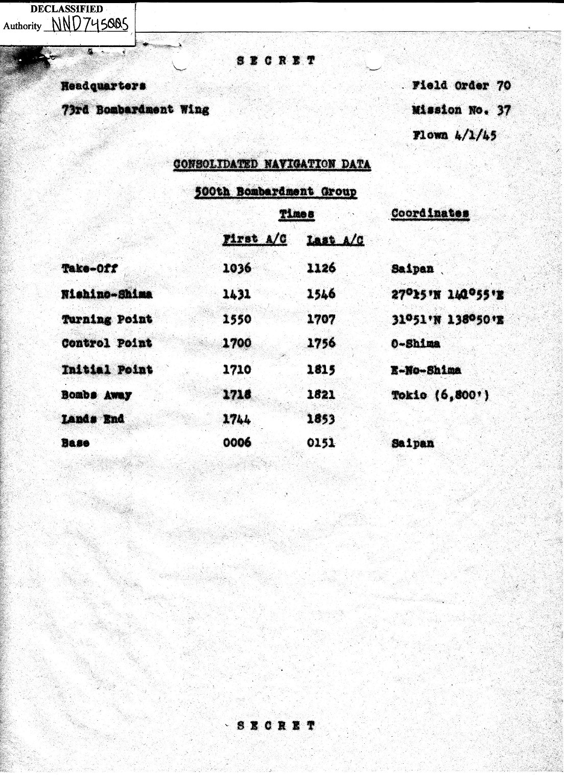
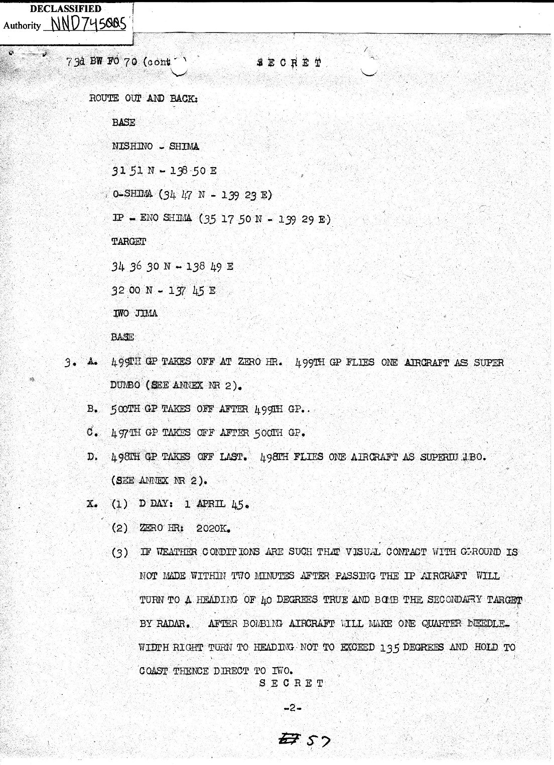
The next two documents have navigation coordinates for
the route to and from Target 357.
The IP ( Initial Point ) is where bomb run begins.
Based on data in the Bombing Report in Page 1,
the time from the IP to Target 357 was 6-8 minutes.
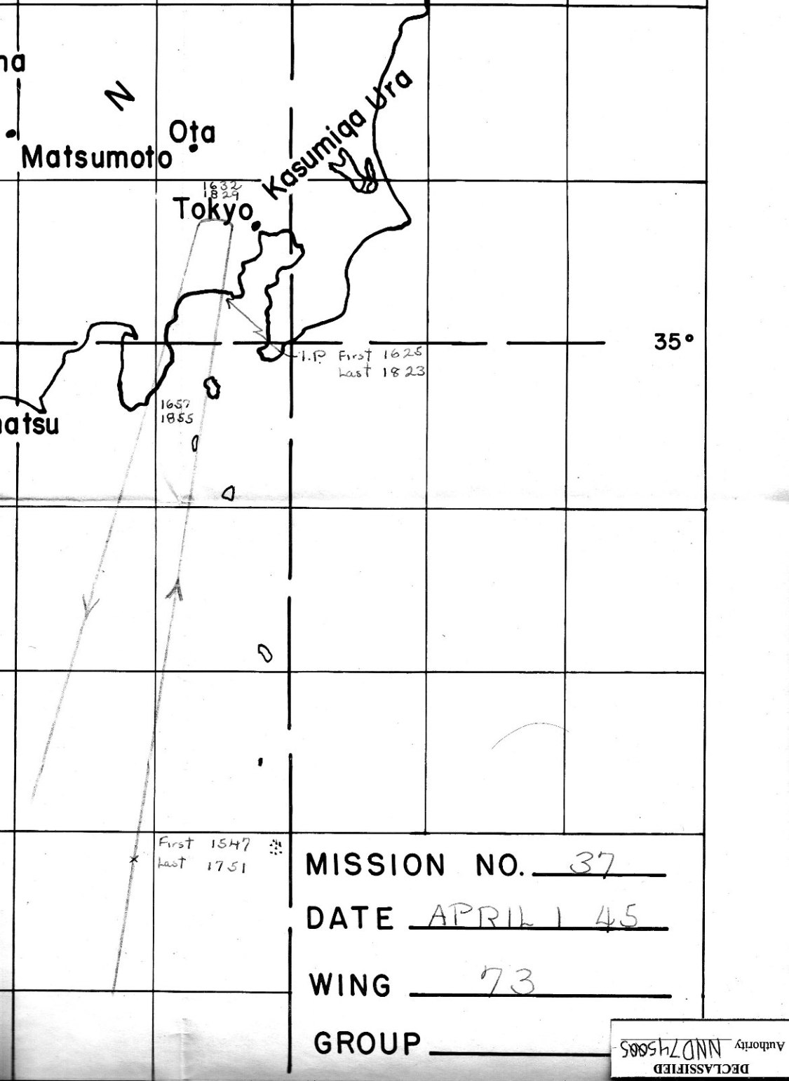
Next are two navigation charts.
The first one is from the Radar Countermeasure report.
The track begins at approximately 26 degrees North
and Target 357 is at 35 degrees 30 minutes North.
The direction of flight to and from
the Target is shown by aircraft stamps.
The next chart is closer in with the times that
the B-29s reached the IP, Target, and Land's End.
These times include all four of the 73rd Bomb Wing Groups.
The 500th Bomb Group was the last to Bomb.
The time that each B29 released its bombs is
in the Bombing Report in Page 1.