Sgt Walter E Walk
Tokyo Kempei Tai Headquarters
73rd Bomb WingMission No. 42
Page 3

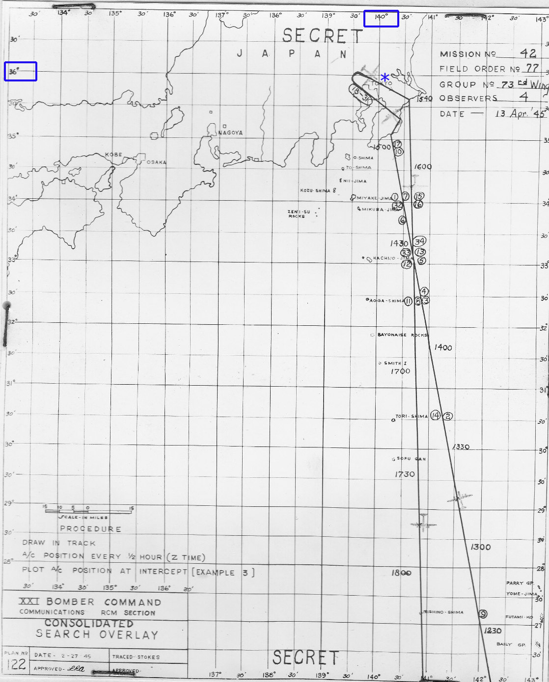
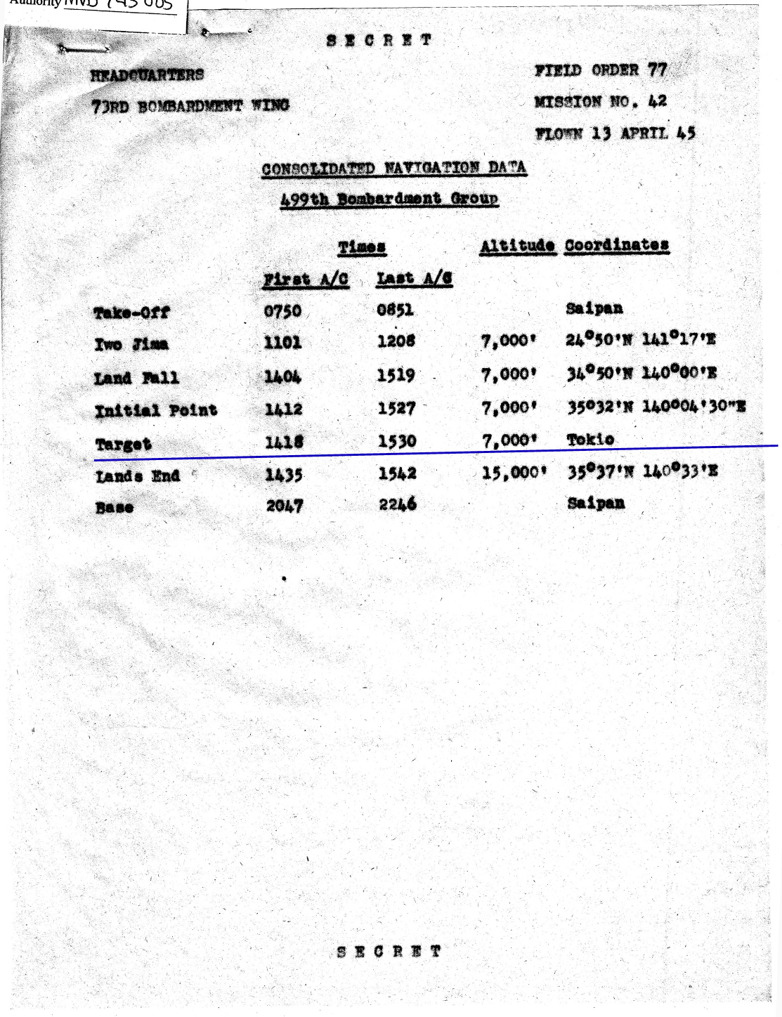
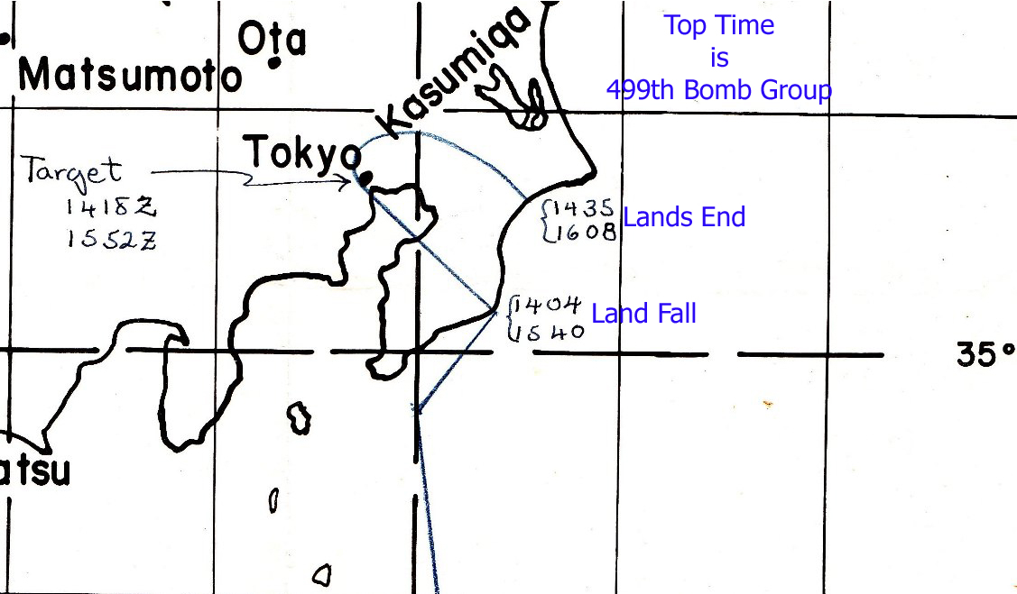
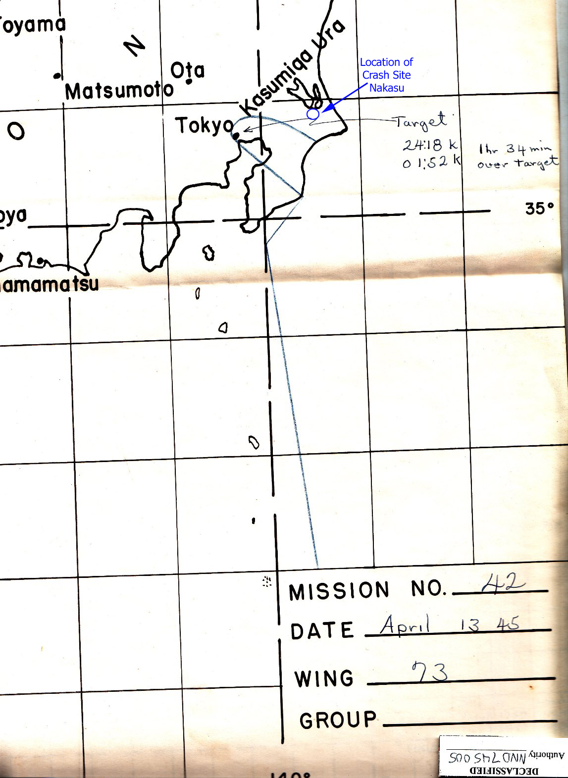
The focus of this page is navigation.

There are three charts and one page from the
Mission Report with locations and times for the 499th Bomb Group.

The first chart was used by the Radar Counter Measure officers.
The aircraft stamps indicate the direction flown by the B29s.

* is the approximate area of where V-23 crashed.

This is followed by a table stating the locations and times where
the 499th Bomb Group was scheduled to be during the mission .

At the bottom are two navigation charts closer in to the target area.

The first is for the 73rd Bomb Wing with
times for first and last aircraft at three locations:

Land Fall
Target
Lands End

The second shows the area where V-23 crashed.


RADAR COUNTERMEASURE ( RCM )
NAVIGATION CHART

BACK TO TOP


499th BOMB GROUP
NAVIGATION DATA

BACK TO TOP

BACK TO TOP