The focus of this page is Navigation and Charts.
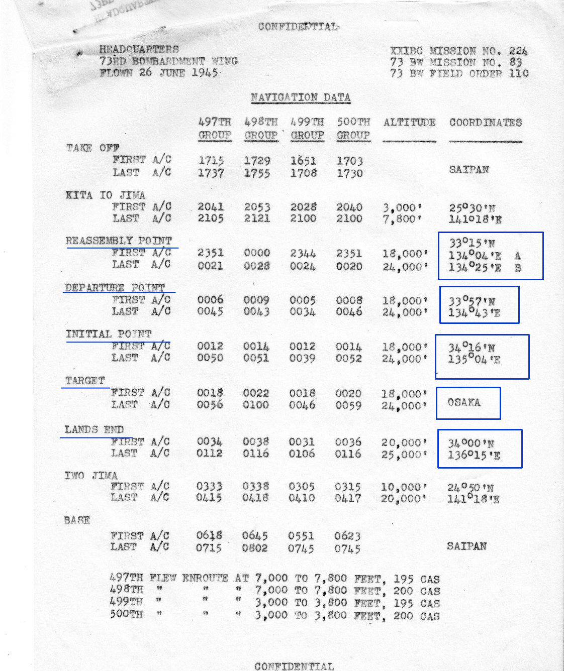
The first document is titled Navigation Data and
contains information for all the Bomb Groups.
The Reassembly Point is near the island of Shikoku.
A right turn was made with the heading to the Departure Point.
The Initial Point ( IP ) is where the bomb run started.
The low altitudes flown on the route to Osaka
were designed to improve fuel consumption.
At a point closer to Osaka the B-29s climbed to bombing altitude.
After the bombs were dropped there was a turn to the southeast
with the B-29s heading to Land Fall.
From there the B-29s would return to Saipan.
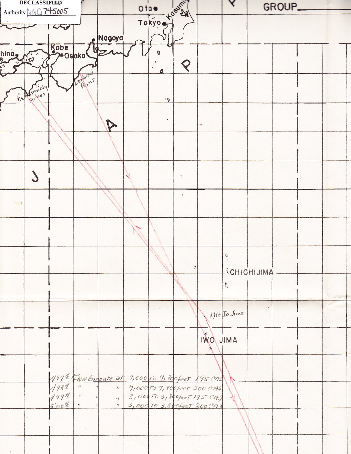
The first chart shows an overall view of the track
that would be flown from Saipan to Osaka and back.
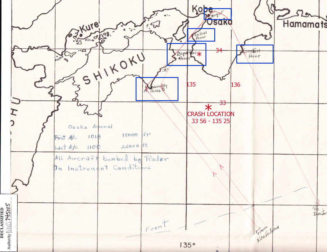
A closer in view is in the second chart.
The red asterisk is the approximate location where V-11 crashed.
Reports state that the last communication from this B-29
was it was about 125 miles away from the target.
The crash site was roughly 50 miles south of Osaka.
BACK TO TOP