Within this page are maps and charts primarily concerned with navigation.
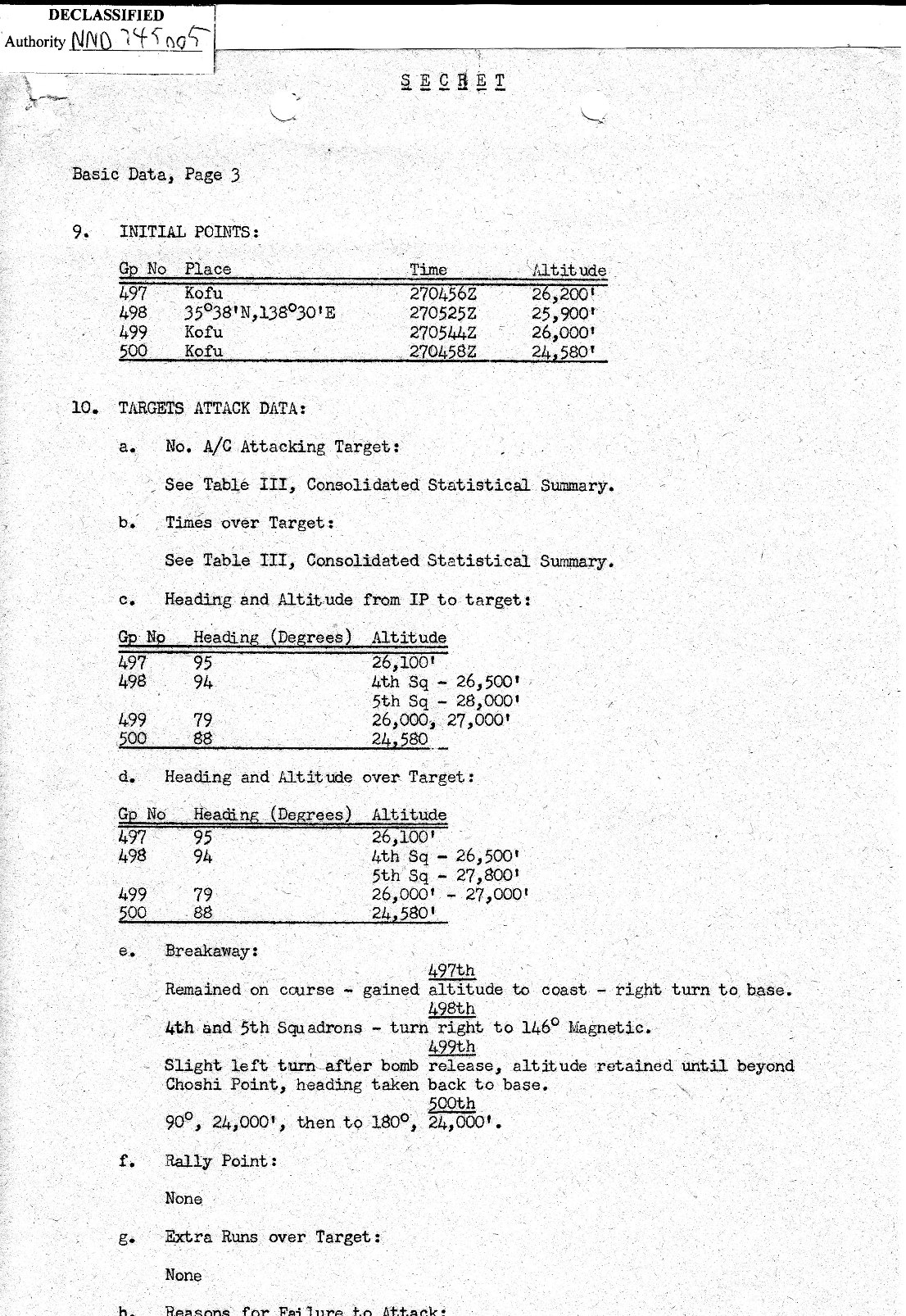
Paragraph 9 in the first page lists the locations of the
Initial Points ( IP ) for each of the Bomb Groups within the 73rd
Bomb Wing.
The IPt was the start of the bomb run.
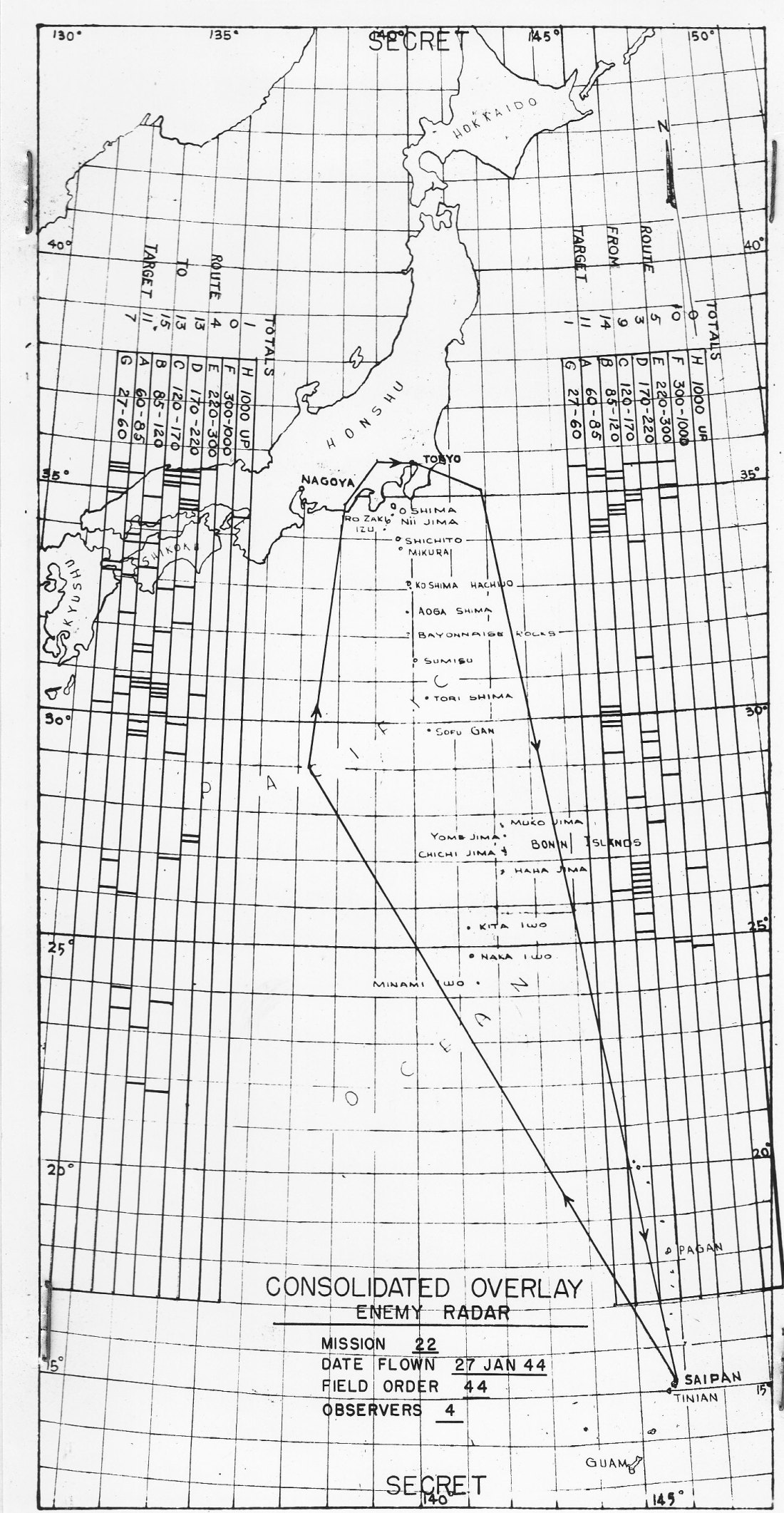
Next is the navigation chart used by the
Radar Countermeasure ( RCM ) Officers.
This chart shows the complete route to and from the target.
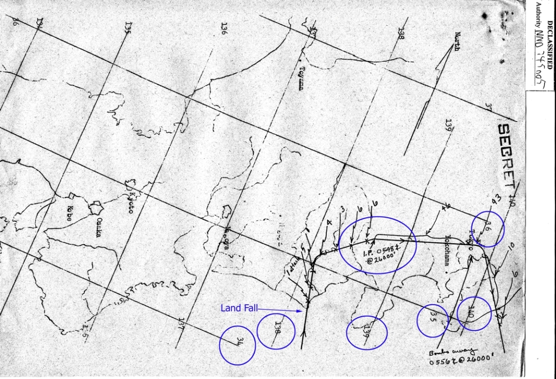
A closer in navigation chart follows with the
approach to Landfall, the turn to the Initial Point,
and then the Initial Point.
None of the B-29s bombed the Primary Target ( 357 ) due to weather
conditions.
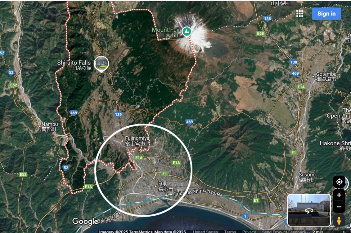
The B-29 flown by Capt Hahn was attacked shortly after
Landfall. The white circle in the Google map shows:
the area where the attacks took place,
the area of the crash,
and where remains of crew members were either recovered or captured.
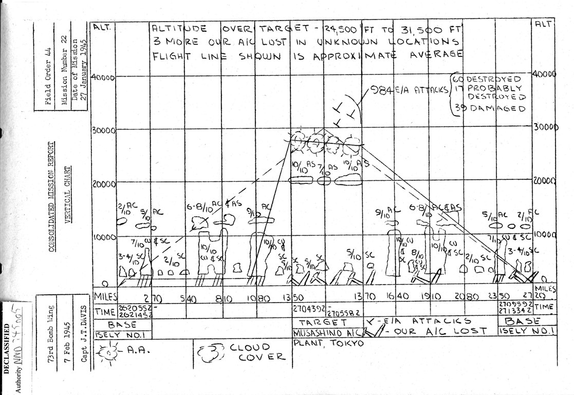
At the bottom of the page is the Vertical Chart.
This chart contains a lot of details, including cloud conditions,
locations of the 984 enemy attacks,
and approximate locations where B-29s were lost.