Sgt Robert Hayes Nead
Tokyo Military Prison Fire
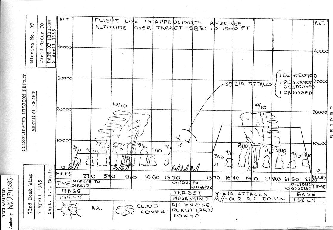
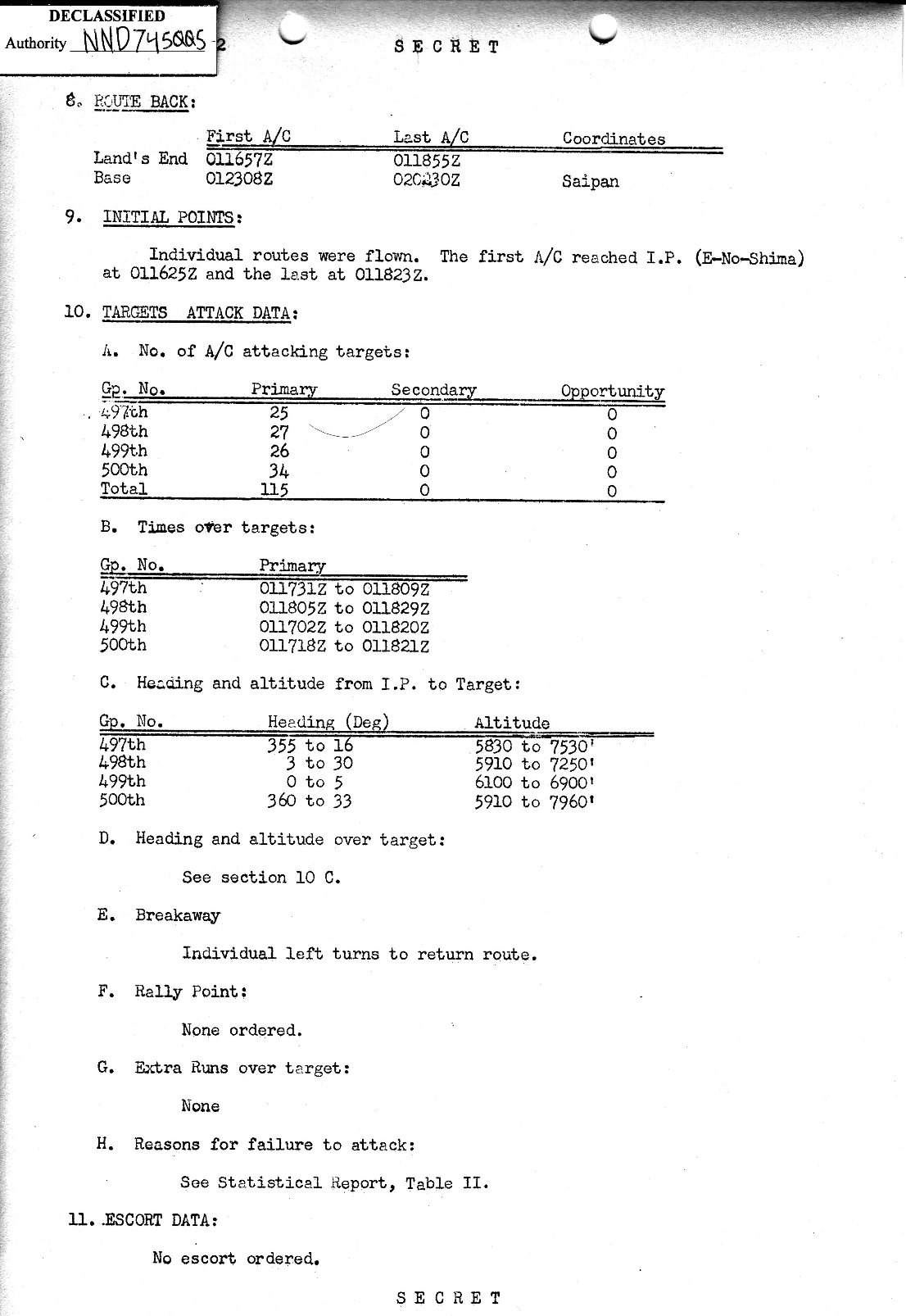
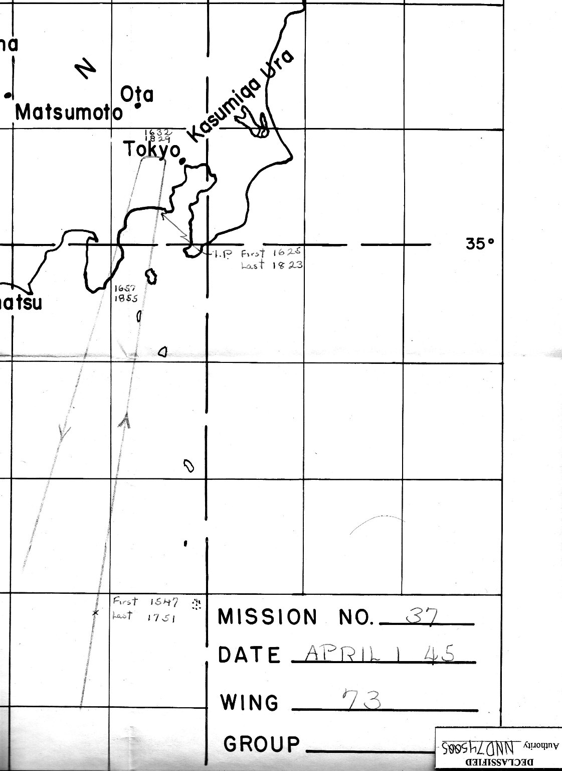
73rd Bomb Wing
Mission 37
Page 3

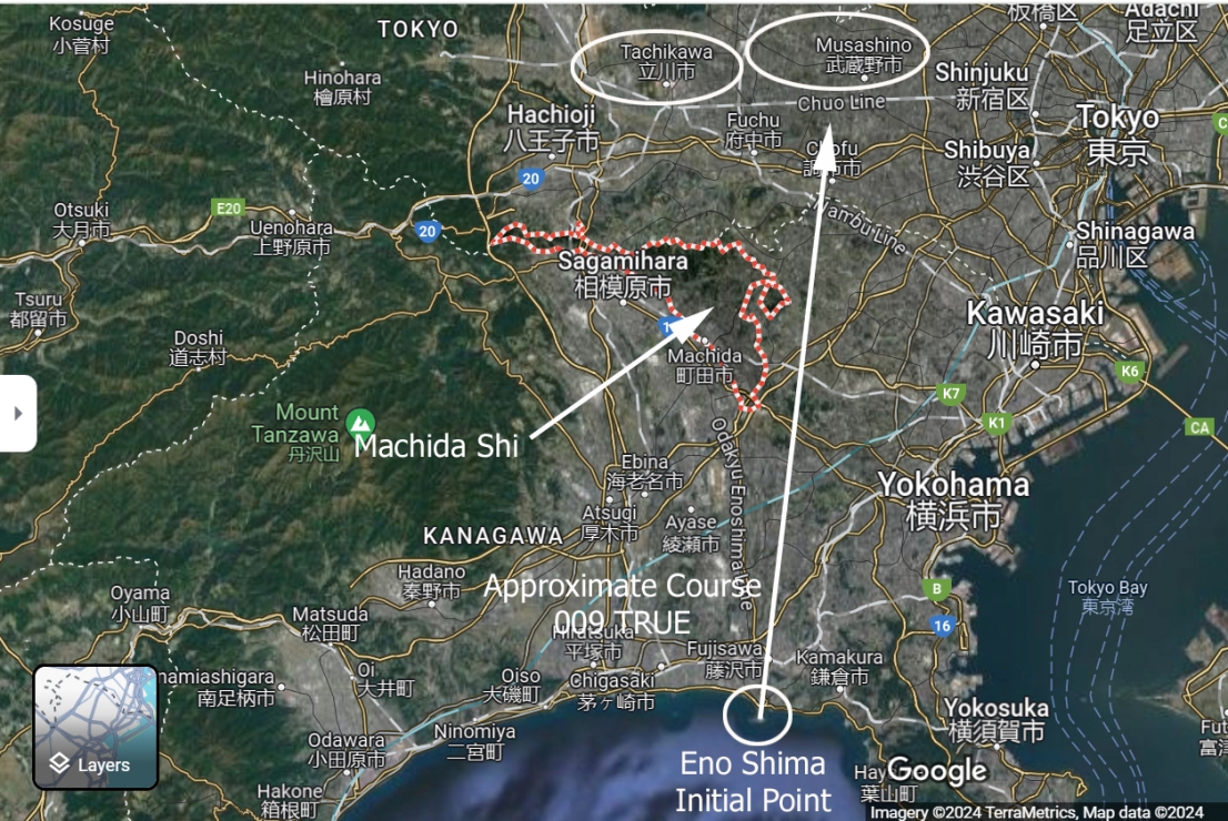
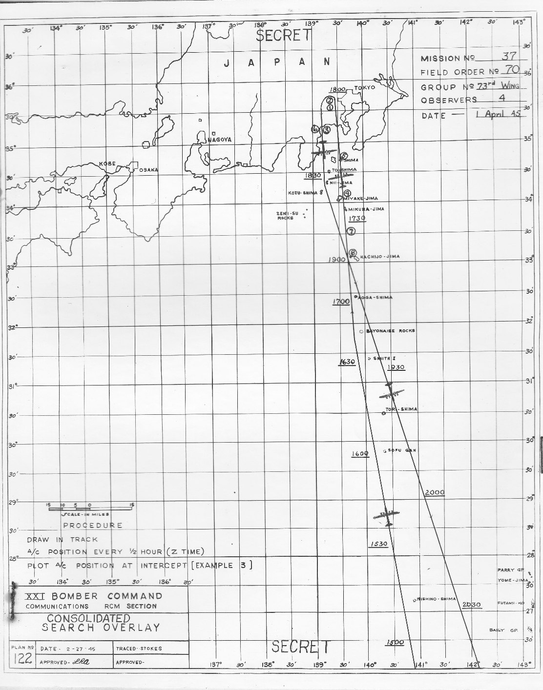
Below is a Google Map with an overview of the mission in the area of Tokyo.

Following this is the Radar CounterMeasure ( RCM ) navigation chart.

Next is the Vertical Chart with information concerning
weather, altitude, and time and distance where B-29s were lost.

The fourth document is a summary of each Bomb Group's
time over target as well as headings and altitude.

At the bottom is an enlarged Navigation Chart
with times that the first and last B-29s were at a specific point.


OVERVIEW


source: Google Maps

BACK TO TOP

RADAR COUNTER MEASURE ( RCM )
NAVIGATION TRACK

BACK TO TOP

VERTICAL CHART

BACK TO TOP

INITIAL POINTS
TARGET ATTACK DATA

BACK TO TOP

NAVIGATION CHART
CLOSE IN VIEW


BACK TO TOP