In Pages 1 and 2 are maps, diagrams, sketches, and Google Maps of
the area around the crash site.
Page 3 has documents related to Recovery.
In Page 4 is a letter dated 14 July 1946
from Sgt Evans
to
The Quartermaster General
********************************************
ACKNOWLEDGEMENTS
Roy Wall
Individual Deceased Personnel Files
for
Captain Stanley H Samuelson
and
Sgt Forrest A Hargrove
Wes Injerd
Documents from the Mansell Pacific POW web site
Material from the Tokyo Broadcasting System
and more
Scott Muselin and Rolland Swank
for guiding me to the
Perry Castaneda Map Collection,
University of Texas, Austin
************************************************
All of the documents and sketches within
this section are from Sgt Hargrove's IDPF.
Sgt Hargrove's remains were recovered at an isolated burial location
in the area where the tail was located.
_____________________________________________
Below are two crops from Sgt Hargrove's
Report of Interment
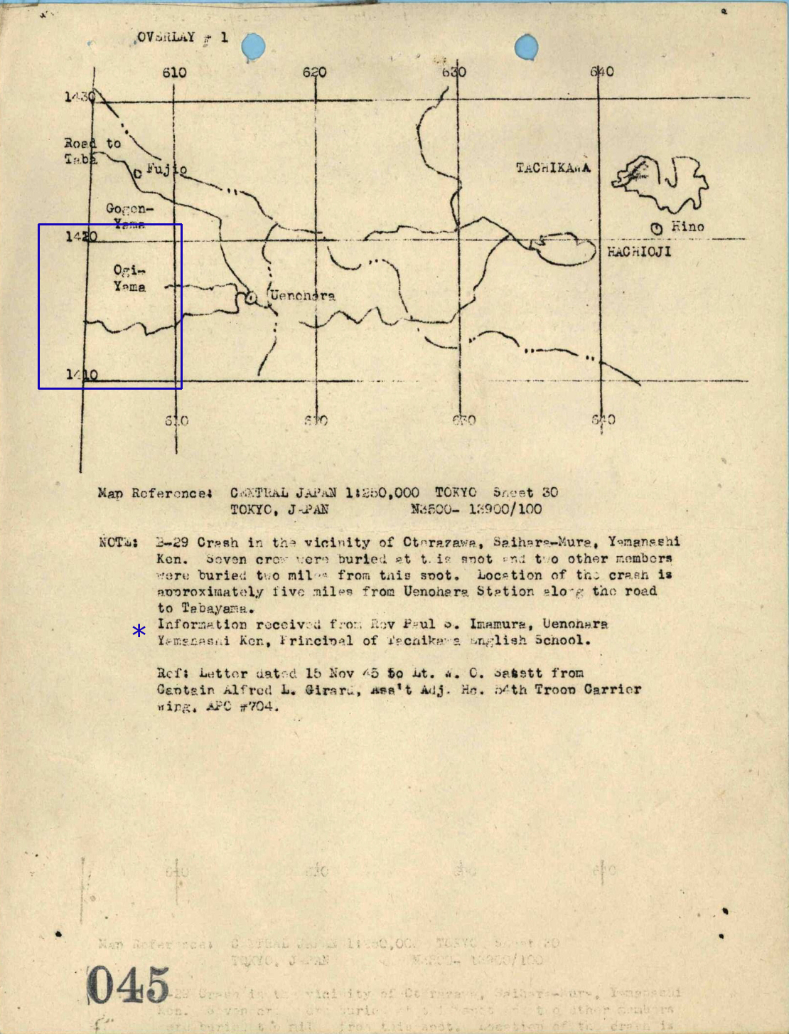
I have been unable to locate Oterazawa.
However there is a similar name,
Aterazawa, in one of the maps in Page 2.
Saihara-Mura : Saihara Village
( Nishihara Village )
The key to locating the correct map is in
the second crop:
Map of Central Japan, 1:250,000, Sheet 30


These coordinates are in the vicinity of Ogiyama ( Mount Ogi )
*****************************************************************
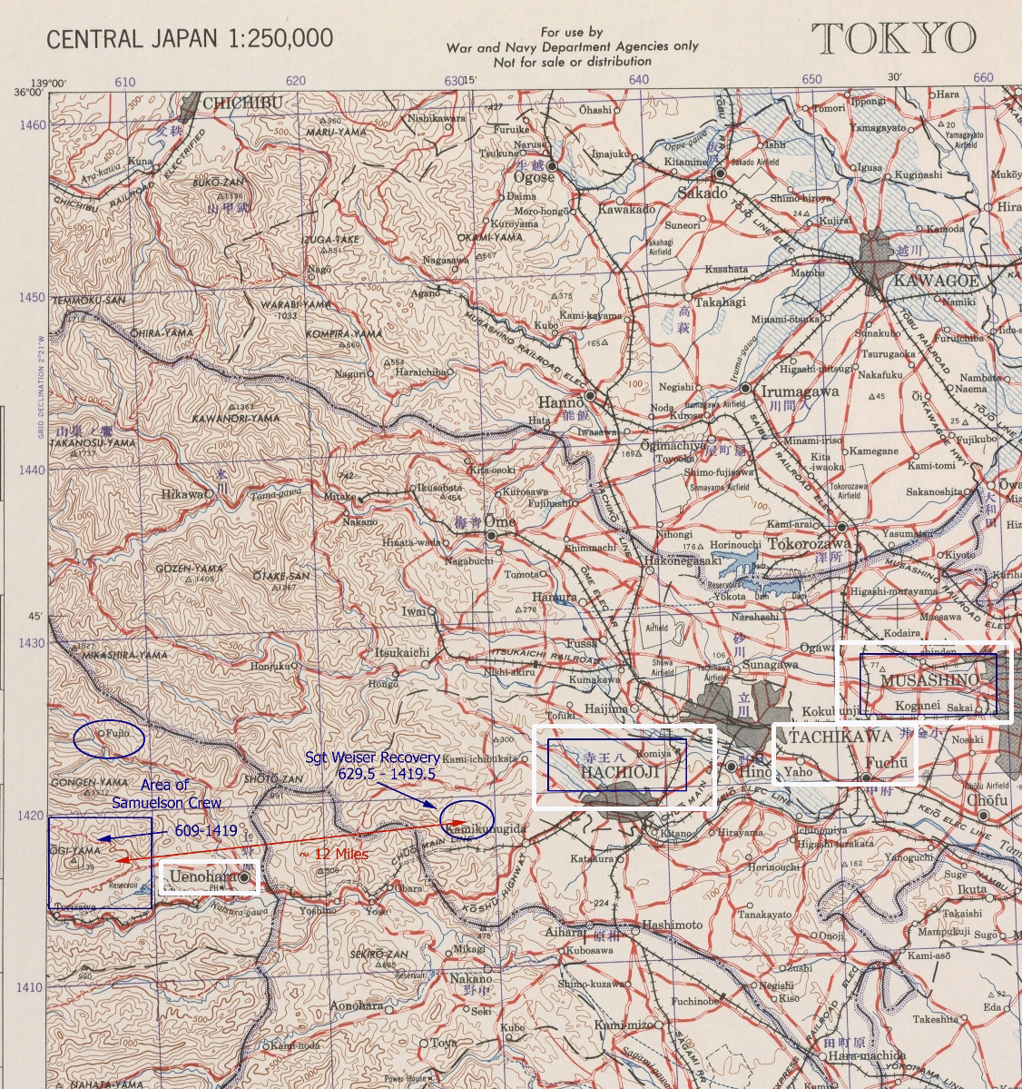
The Tokyo map following this commentary shows the location where
Capt Samuelson and seven of his crew were recovered .
This is at the left side.
The blue oval to the right is where
Sgt Evans and Sgt Weiser landed in the
vicinity of Ongata-Mura ( Ongata Village ).
Hachioji is close to Ongata Village and mentioned
in some of the documents.
Tachikawa and Musashino are outlined in white.
The location where Sgt Janecek was captured
is not stated in any document.
Sgt Evans was the only one of the crew to survive.
_____
This is followed by a hand drawn map that is easier to read.
Mount Ogi ( Ogiyama ) is outlined with a blue square.
At the bottom are comments concerning the crash location.
_____
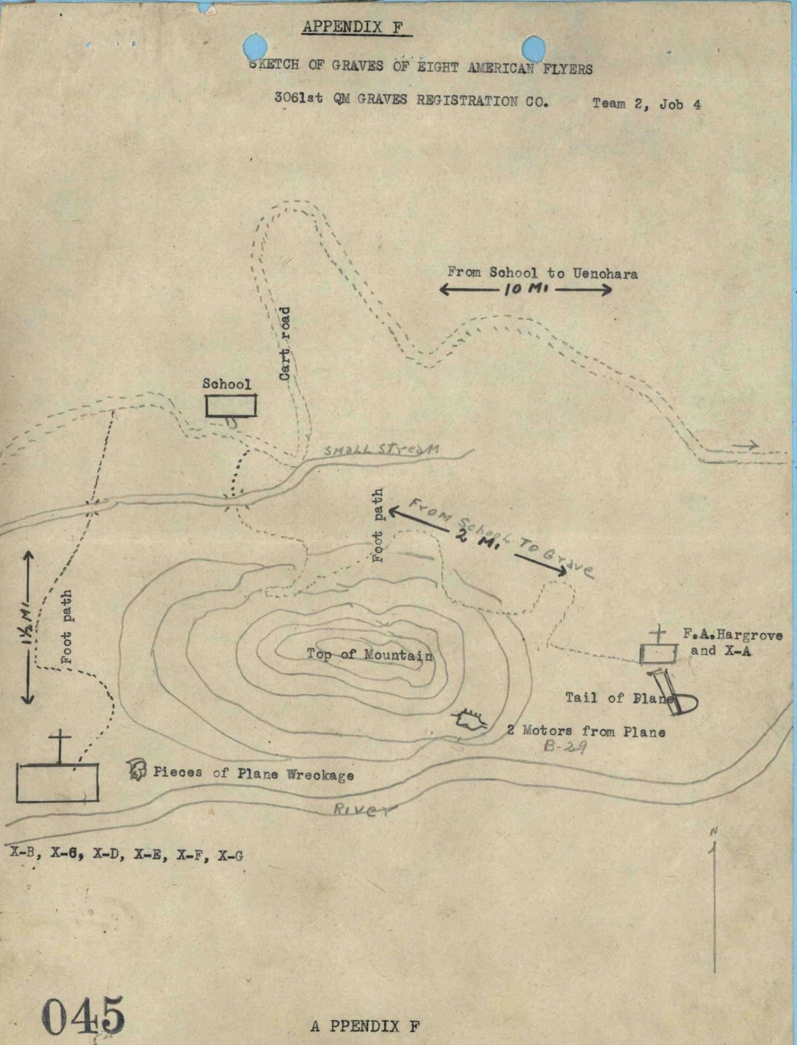
The third diagram is a sketch found in
both Capt Samuelson's and Sgt Hargrove's IDPFs.
There are distances but nothing to indicate
whether or not this is drawn to scale.
This area is rugged mountain terrain with
the peak of Ogi Yama at 1138 meters ( 3734 feet ).
Nishihara Village may be at an altitude of 500 - 1000 feet.
( Based on estimates from the surrounding area. )
The remains of Sgt Hargrove and ( Unknown X-A )
were recovered at an isolated location at the
right side of the sketch near the tail.
******
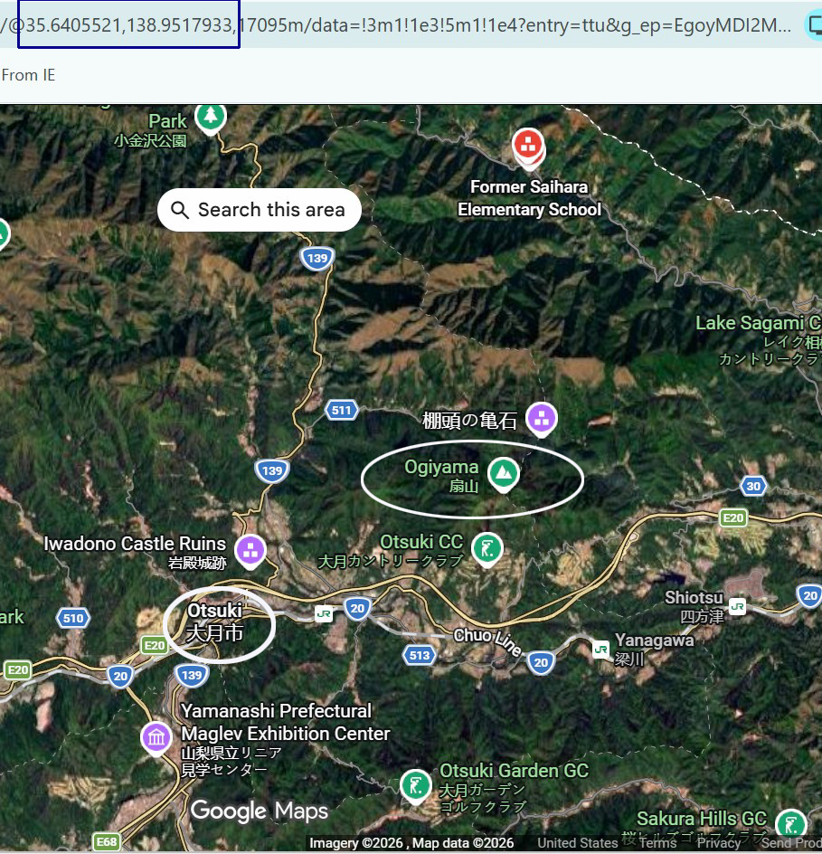
At the bottom of the page is a Google map sent to me by Wes Injerd.
The valley where Nishihara Village is located is barely visible.
The school is located at the top and
Ogiyama is outlined with a white oval.
Google Maps in Page 2 focus on this area.
BACK TO TOP