Sgt Charles Richard Weiser
Ongata Village

Case History 045
Page 2


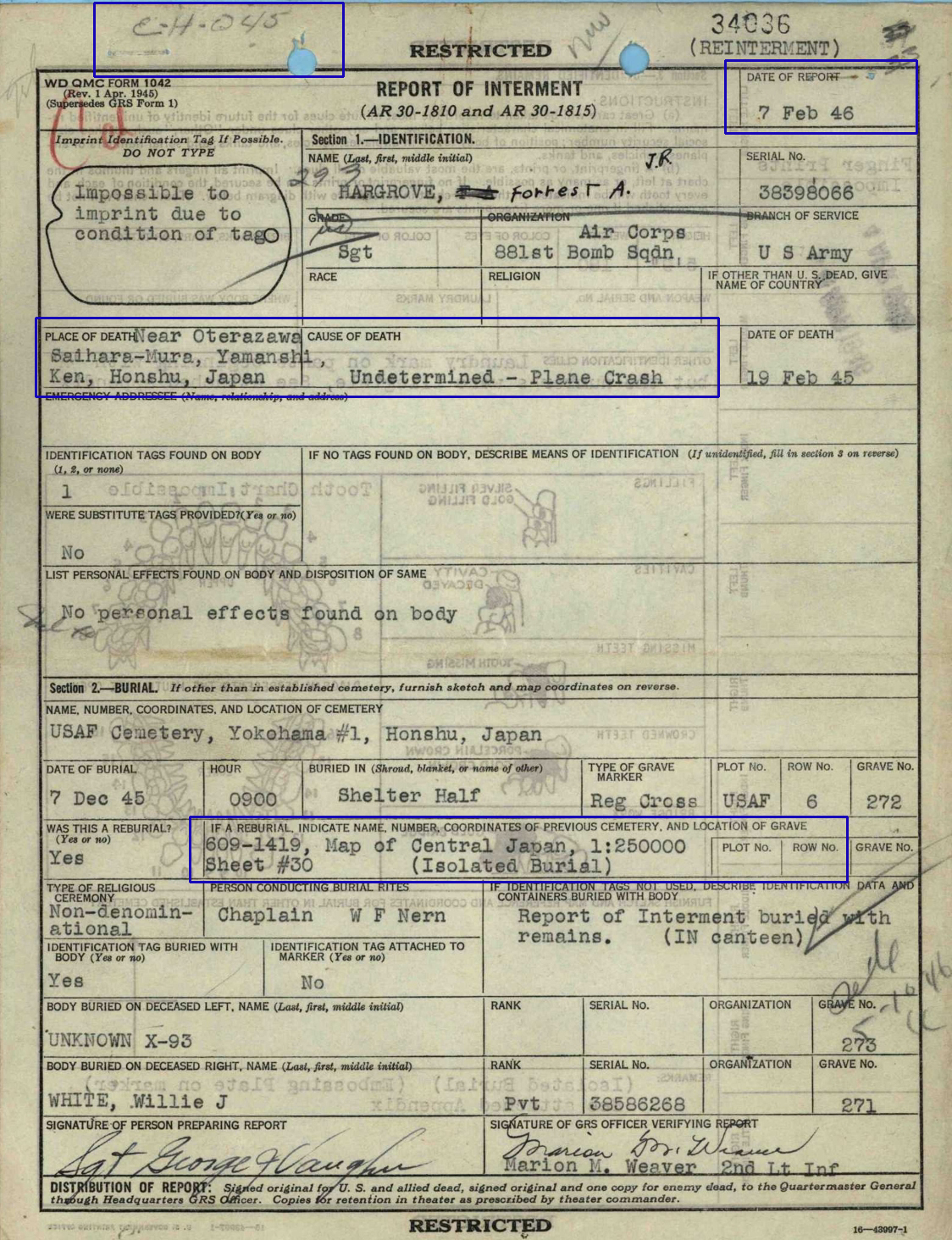
The first document is
Sgt Hargrove's Report of Interment

Highlighted are

His Place of Death
( Oterazawa, Saihara-mura, Yamanishi-ken, Honshu )
and
the coordinates of his burial location.

_________________________

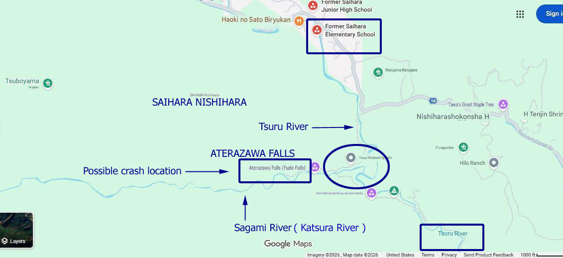
The first map shows the location where Lt Hirose's fighter crashed.

It is also possible that this is close to where
Capt Samuelson's B-29 crashed.

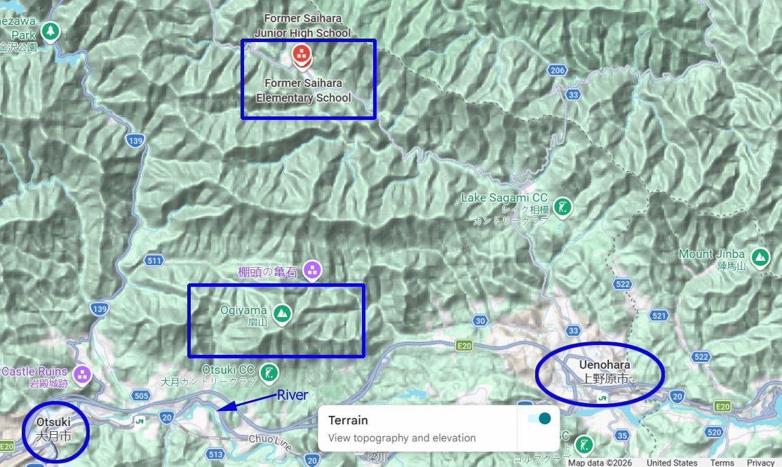
In the terrain map that follows, the valley where the school
was located can barely be seen.

The arrow is pointing towards the Katsura River and the
Chua Line ( possible railroad )

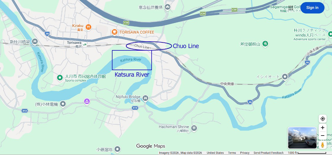
A closer in view is in the map at the bottom of the page.

BACK TO TOP


REPORT OF INTERMENT
SGT FORREST A HARGROVE


BACK TO TOP

PROBABLE LOCATIONS OF LT HIROSE CRASH SITE
AND WHERE PARTS OF B-29 CRASHED

source: Google Maps

BACK TO TOP

TERRAIN MAP
SCHOOL, OGIYAMA, AND RIVER

source: Google Maps

BACK TO TOP

THE KATSURA RIVER
ALSO KNOWN AS SAGAMI RIVER

source: Google Maps


BACK TO TOP