Sgt Charles Richard Weiser
Ongata Village
Samuelson Crew
Page 7


August 2026

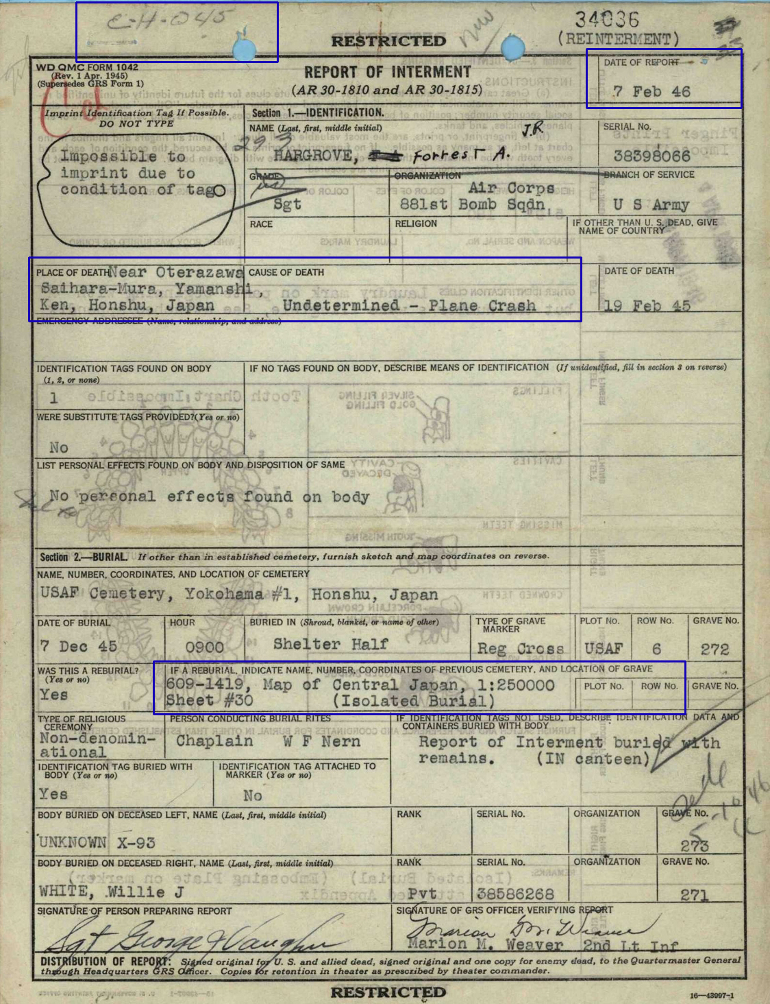
In July 2026 Roy Wall sent me Sgt Hargrove's IDPF and
in the first document, Report of Interment, the location and coordinates of
the crash site is outlined in blue.

_____________________________

Wes Injerd also sent me information that helped to
find the general area of this location, Nishihara Village.

Another of his sources is the Tokyo Broadcasting System.

During 2012 there was a broadcast concerning the 19 February 1945 crash.

Three or four residents who witnessed the crash in either
Nishihara Village or
Sgt Weiser's landing in Ongata Village were interviewed.


Wes found two articles based on this broadcast.
This was dated 19 February 2025.
These links will take you to the web site.

Nishihara

Ongata Village

________________________________

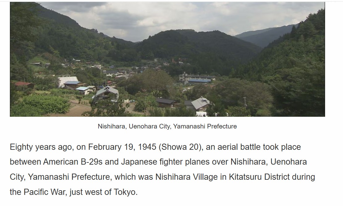
A photo of Nishihara Village follows
Sgt Hargrove's Report of Interment.

Next is a Google Map with the track that the
B-29s flew between the
Initial Point at Kofu and
the Secondary Target at the Tokyo Dock Area.
Uenohara is outlined with a white oval.

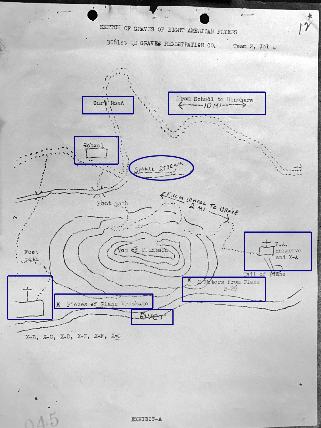
The sketch below the map is in both
Capt Samuelson's and Sgt Hargrove's IDPFs.
This was drawn by the Recovery Team that located the crash site.

A school is outlined in a blue rectangle at the left side.

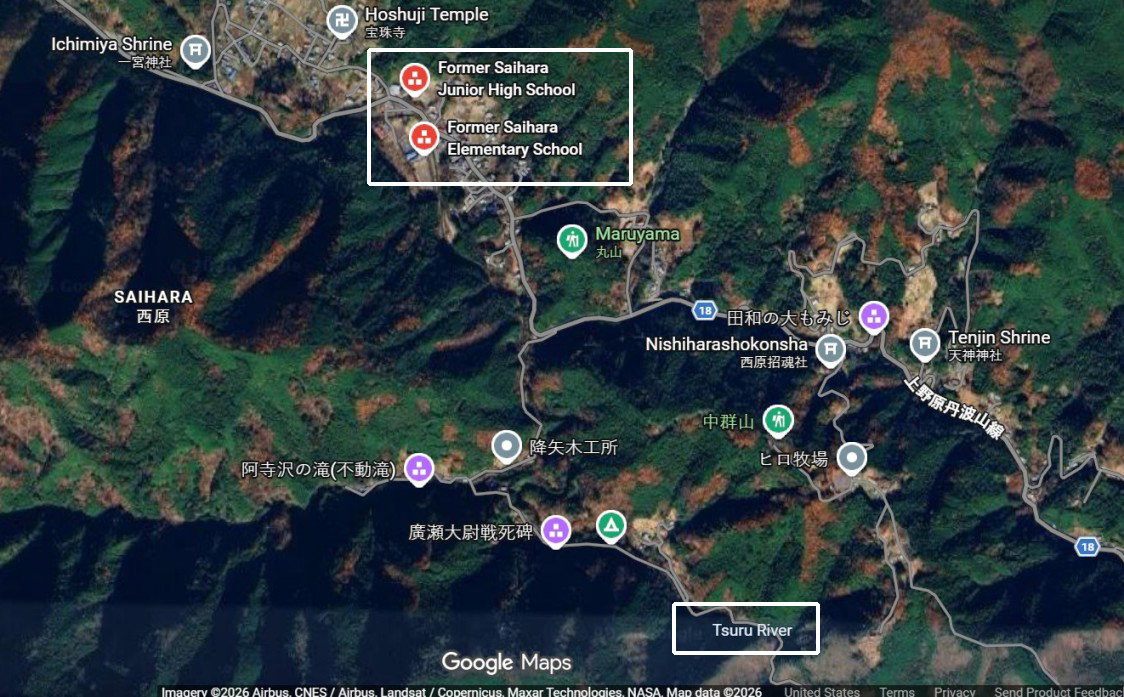
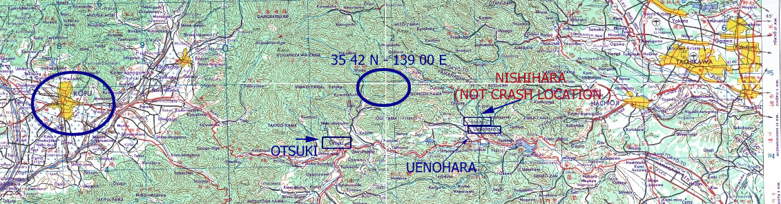
Wes sent me two Google Maps with
the locations of the two schools in Nishihara Village.

Using Google maps I was able to get
the coordinates of one of the schools.

The first of the two versions has a wide view similar to the track map.
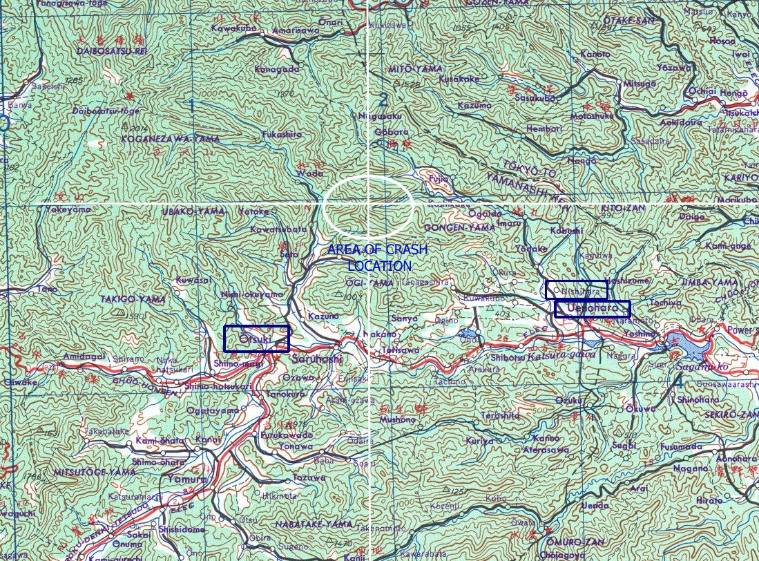
This is followed by a closer-in view of the area.

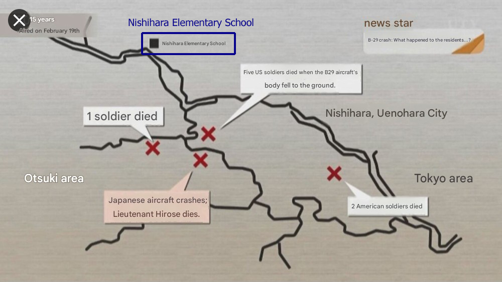
At the bottom of the page is a graphic from one of the articles
from the Tokyo Broadcasting System.

The location of one of the schools is at the top.


RED X's

are where the Crew members were recovered and
the Japanese pilot crashed
.


BACK TO TOP


REPORT OF INTERMENT
SGT FORREST A HARGROVE
LOCATION OF CRASH
AND
COORDINATES
ARE OUTLINED WITH BLUE RECTANGLE

BACK TO TOP


NISHIHARA VILLAGE

source: Tokyo Broadcasting Service


TRACK FLOWN BY B-29s FROM
INITIAL POINT, KOFU, TO
SECONDARY TARGET AT TOKYO DOCK WORKS
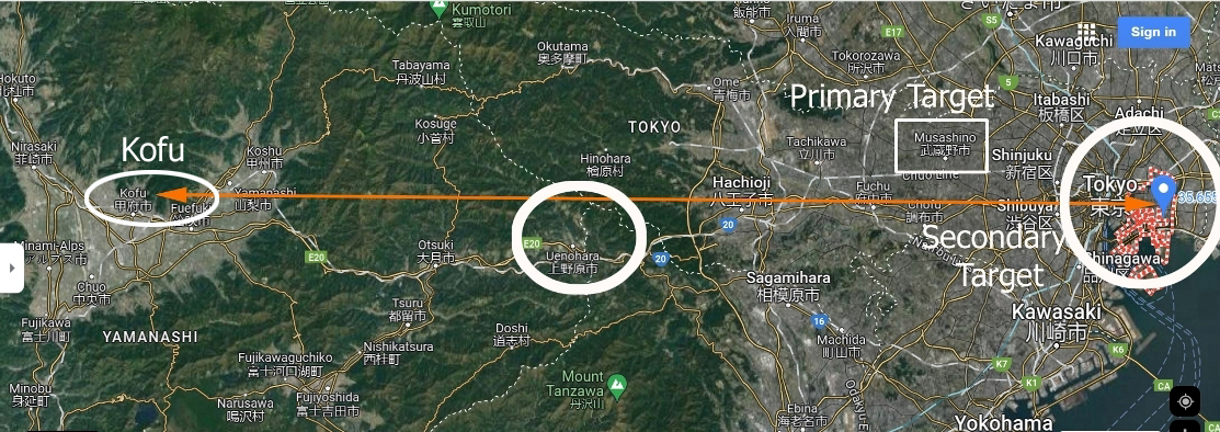
source: Google Maps

BACK TO TOP

SKETCH OF AREA WHERE B-29 CRASHED IN NISHIHARA VILLAGE
AND
EIGHT CREW MEMBERS RECOVERED

DISTANCE FROM SCHOOL TO UENOHARA
IS ~ 10 MILES


source: Captain Stanley Samuelson IDPF


LOCATION OF FORMER SCHOOLS
IN NISHIHARA VILLAGE

source: Google Maps

BACK TO TOP

COORDINATES WHERE SCHOOLS IN
NISHIHARA VILLAGE WERE LOCATED

source: Perry Castaneda Map Collection
University of Texas, Austin

BACK TO TOP

CLOSER IN VIEW OF COORDINATES
CRASH TOOK PLACE BELOW THIS INTERSECTION

source: Perry Castaneda Map Collection
University of Texas, Austin

BACK TO TOP

LOCATIONS OF
THE NISHIHARA VILLAGE ELEMENTARY SCHOOL
AND
THREE AREAS WHERE CREW MEMBERS WERE RECOVERED

JAPANESE AIRCRAFT CRASH


source: Tokyo Broadcasting System

BACK TO TOP