SSgt Howard Russell Woleslagle
Osaka Castle

Captain James Newell Crew
Page 2

There are four maps in this this page.

They cover the area of the crash site and the
locations where nine of the crew were captured.

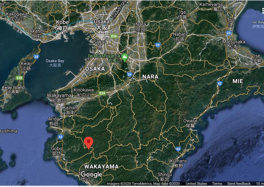
The first one is a Google map with Osaka at the top and
Mt Seirei ( Seirei-Zan ) at the bottom
( red pointer ).
This is the crash location.

________________

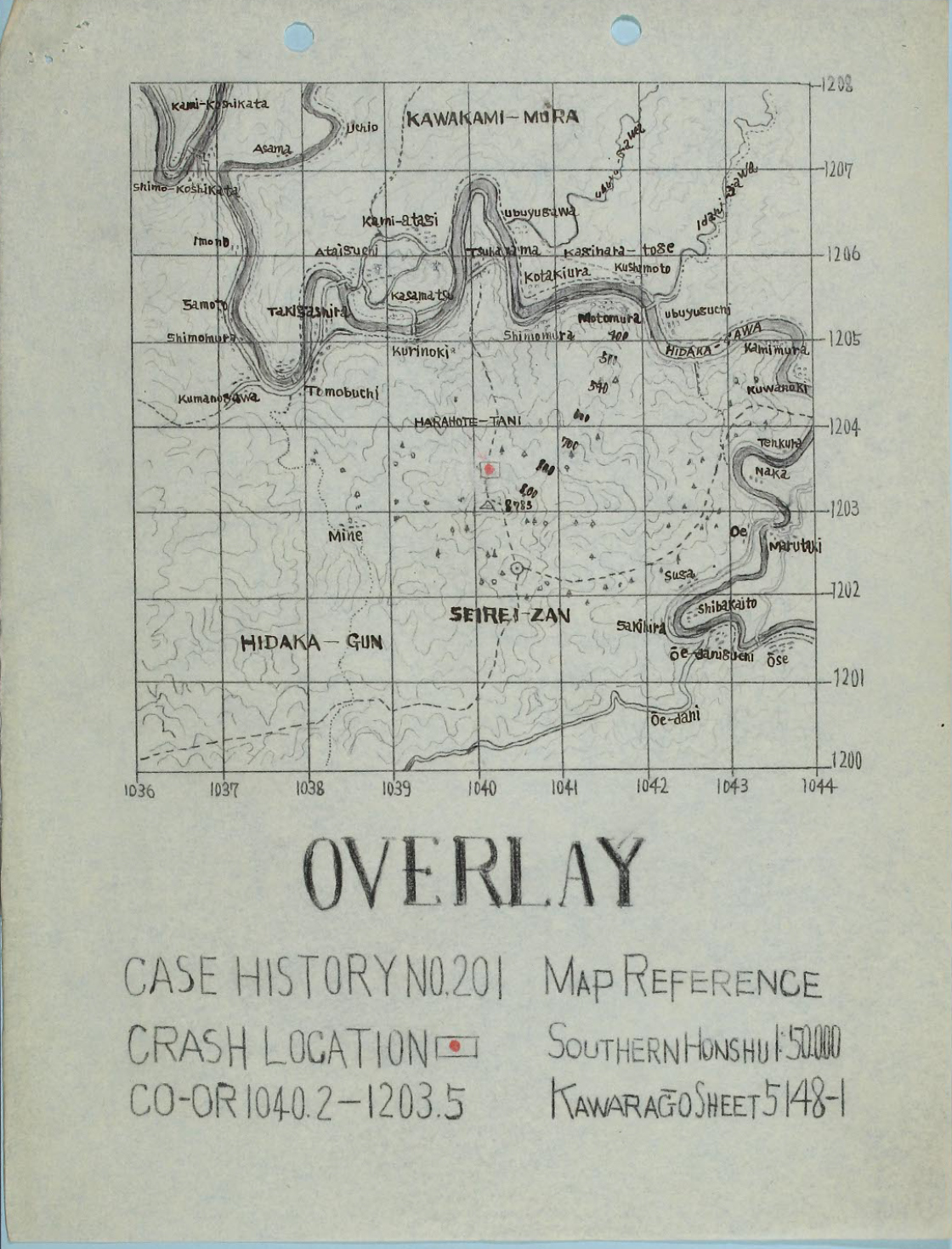
Two versions of map 5148-1 from the
Army Map Service (AMS) Series L775 follow.

The first is titled Overlay and Seirei-Zan is
outlined with a red circle within a rectangle.

The coordinates for this location are
1040.2 - 1203.5
___________________________

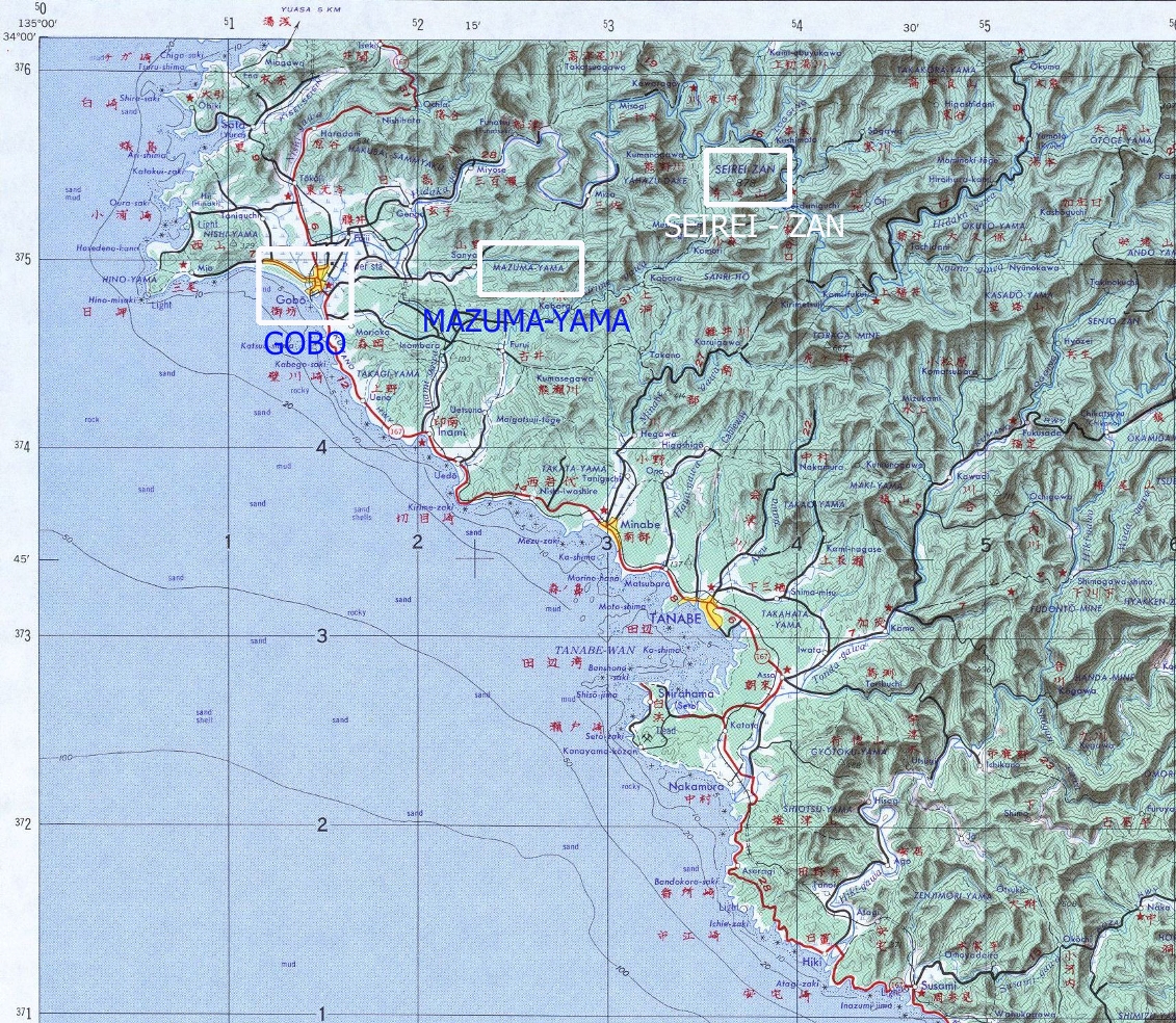
The next map shows the crash site and the
locations where nine members of Capt Newell's crew were captured.

SSgt Howard Woleslagle, SSgt John Wall, and Sgt Raymond Shiber
wandered for six days and were captured in the area of Mazuma.

_____________________

At the bottom is a topographical map with the locations of:

The crash site at Seirei-Zan, Mazuma, and Gobo.

The survivors were transported to the Kempei Tai at Gobo.

BACK TO TOP


ORIENTATION MAP
OSAKA IS AT TOP
CRASH LOCATION IS EAST OF GOBO

source: Google Maps

BACK TO TOP

OVERLAY MAP
COORDINATES ARE AT THE BOTTOM OF THE PAGE

THE CRASH SITE IS A FAINT RECTANGLE WITH A RED CIRCLE INSIDE


BACK TO TOP

THE LOCATIONS WHERE CREW MEMBERS WERE CAPTURED
ARE OUTLINED WITH WHITE RECTANGLES

THE CRASH SITE IS OUTLINED WITH A RED SQUARE

SSGT WOLESLAGLE AND TWO OTHERS WERE CAPTURED
AT MAZUMA-MURA AT LOWER LEFT

MAP COORDINATES ARE A
'+' SIGN OUTLINED
WITH A THICK ROUNDED SQUARE
AND LARGE NUMBERS

ARMY MAP SERIES L775
SHEET 5148-1

source: Perry Castaneda Map Collection
University of Texas, Austin

BACK TO TOP

MAZUMA-YAMA
IN RELATION TO
THE CRASH SITE AT SEIREI - ZAN
AND
GOBO

ARMY MAP SERIES L506
NI 53-7

source: Perry Castaneda Map Collection
University of Texas, Austin

BACK TO TOP